Variation of hydrological processes and water balances
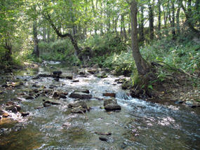
Flöha watershed located in the border area of Germany and Czechia
Image Credit: Ramelow, M. 2006
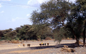
Wadi in semi-arid area in northern Kenia
Image Credit: Stumptner, A. 2004
The amount and intensity of precipitation and proportions which infiltrate, percolate, run on the surface downslope and evaporate fluctuate in the watershed through the year – according to rainy and dry seasons or winter and summer seasons in the respective watershed.
From watershed to watershed the amount, intensity and frequency of precipitation and the rates of the individual processes of the hydrological cycle also vary. This depends on the specific characteristics of the individual watersheds (see figure 1 and 2). If, for instance, the soil is relatively impermeable due to compaction like in the Gina River catchment, less water can infiltrate into the soil. A greater amount of precipitation will under these conditions run downward as overland flow. Thus, also the water balances of different watersheds vary (Ahnert 1996; Tidemann 1996).
The water balance portrays the hydrological cycle quantitatively:
Precipitation = evapotranspiration + discharge
Discharge is the total volume of water flow per unit of time at any point along the river (Bradshaw and Weaver 1995).
This equation describes the renewable supply of water within the watershed in the long-time average. In order to calculate the actual supply of water at a specific point of time the circulating ground water has to be considered as well (Baumgartner and Liebscher 1996). The ground water is, of course, a part of the whole hydrological cycle.
Precipitation is an important factor which directs the various processes proceeding within watersheds.
Slope dynamics are described in the following.

