North of Labeatis Fossae – Sculpted by Nature
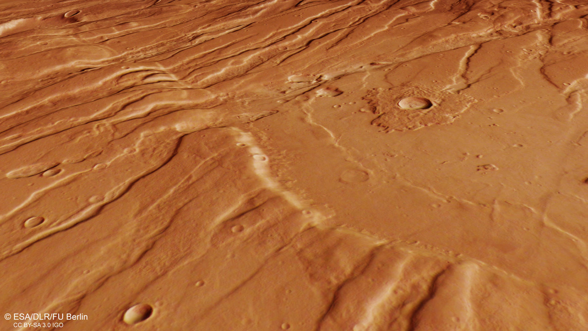
A breathtaking view of the fractured Martian surface displays the tremendous force that acted on the crust. Located northeast of the Tharsis volcanic province, the region is a prime example for so-called horst and graben structures, that were also featured nearby in Ascuris Planum (PR July 2015). This time however, different lighting conditions, a consequence from Mars Express’ unique elliptical orbit and different observation times result in a magnificent artwork of nature.
How are horst and graben structures created?
The region shown on the HRSC images shows a so-called horst and graben tectonics, as in the textbook. If a rigid, brittle rock crust is stretched, for example because the ground is raised, the surface above it comes under tension. If the strain stress rises above the limits "bearable" for the rock, the crust breaks up along more or less steeply falling fracture surfaces: A "fault zone" is created. If the crust continues to expand, large blocks of rock slide along the fracture surfaces for several hundred metres, in some places even one to two thousand metres into the depths: over many millions of years, a tectonic trench develops. The blocks left standing on both sides now tower above the landscape and form the associated nests. The word pair "horst and graben" has its origins in early medieval miner's German and was adopted into the language after geology was established as "earth science". It is also used in this wording in other languages.
Formed by extensional fractures …
During the slow buildup of the Tharsis bulge which stretches over several thousand kilometers and rises five kilometers above the surrounding plains, the stress in the crust lead to multiple extensional fractures and also recorded changes in the stress direction. Numerous faults and ridges running perpendicular to the main direction can be found in the southern (left) part of the plan view image.
… and smoother hills
The landscape in the northern pat of the image (right) shows a much smoother profile. The grabens appear partly filled and in the upper part of the image, so-called wrinkle ridges can be found. They develop through cooling and solidification of lava and point to the very deep reaching fractures in this region.