We Took Part in the MINToring Programme 2025!
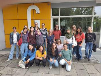
The girls and instructors participating in the mintoring day 2025
The partcicipants creating some maps in the PC la
News from Aug 19, 2025
On July 10th, our working group "Modelling Human-Environment Interactions" once again took part in the FU Berlin MINToring programme - an initiative that introduces high school girls to physics, computer science, and geosciences to foster their interest in these fields, particularly where women are traditionally underrepresented.
As part of the multi-week internship, we hosted a three-hour workshop titled “Deforestation in South America”.
The workshop was led by several members of the MHEI team. Jun.-Prof. Dr. María Piquer-Rodríguez introduced the group and welcomed the participants. Ahuvit gave a short presentation on the history of remote sensing. The students then engaged in a remote sensing-themed game, with one group composed of Ahuvit, Lia, and Sole, and the other with Karla and Lucía. Although Mónica was unable to attend due to illness, she contributed to designing the activity. During the QGIS mapping session, Karla and Lucía guided the main exercise, with additional support from Lia, and Sole.
Eleven students from various Berlin schools joined us for an engaging session that began with a short scavenger hunt and an introduction to remote sensing. Participants learned how satellites collect environmental data and how scientists use this information to observe land-use changes over time.
In the hands-on part of the workshop, the students created their own digital maps using QGIS, visualizing deforestation trends in different regions of South America. They discussed how land-use changes such as forest loss and agricultural expansion affect biodiversity, climate, and local communities. The group also visited the university’s map collection, gaining insight into the historical and scientific importance of cartography, for this we want to thank the geo-library and Lina Geiges-Erzgräber especially!
We thoroughly enjoyed the opportunity to share our passion for geography and geoinformation science with the next generation of researchers. A big thank you to all participants for their curiosity and enthusiasm!

