1. Cryovolcanic Processes and Topographic Modeling
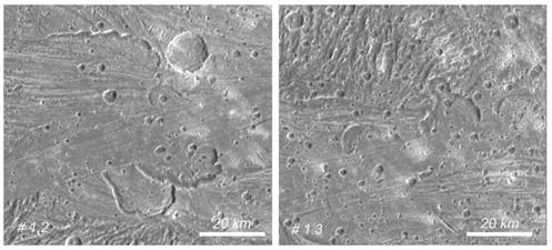
During the Voyager and Galileo missions, isolated regions on Ganymede’s surface exhibited signs of possible cryovolcanic activity, characterized by "scalloped depressions" or "paterae" resembling calderas. However, limited spatial resolution prevented acquisition of detailed data on their topography, age, and surface composition, restricting definitive identification of cryovolcanism or its implications regarding Ganymede’s subsurface ocean and habitability. More recently, JunoCam aboard NASA’s Juno spacecraft has identified numerous new paterae on Ganymede, enhancing the data pool and enabling improved planning for future observations.Recent studies have revealed compelling evidence for shallow liquid pockets within Europa’s ice shell, with surface fracture patterns indicating tectonic and possible cryovolcanic influences.
Possible cryovolcanic activity has not been observed at sufficient spatial resolution to characterize features on Ganymede fully. As a result, critical information about local topography, surface age, and composition remains lacking. The generation of digital elevation models (DEMs) from existing data sets is essential for optimizing and guiding forthcoming JANUS observations. In the absence of stereo images, 3D models are derived using single-image methods like photoclinometry.
Key Tasks:
-
Create elevation models and image mosaics of Ganymede and Europa from historical mission data
-
Analyze image data for signs of cryovolcanic activity and shallow liquid pockets
-
Compare geological observations between Ganymede and Europa

Paterae on Ganymede