Department of Earth Sciences
Service Navigation
Nectaris Fossae & Protva Valles
Image data, taken by the High Resolution Stereo Camera (HRSC) on board ESA’s Mars Express mission show a geologically complex region at the flanks of Thaumasia Planum. HRSC is a camera experiment that was developed and is operated by the German Aerospace Center (Deutsches Zentrum für Luft- und Raumfahrt; DLR).
» read more in the main article below...
Nectaris Fossae & Protva Valles • Position & 3D view

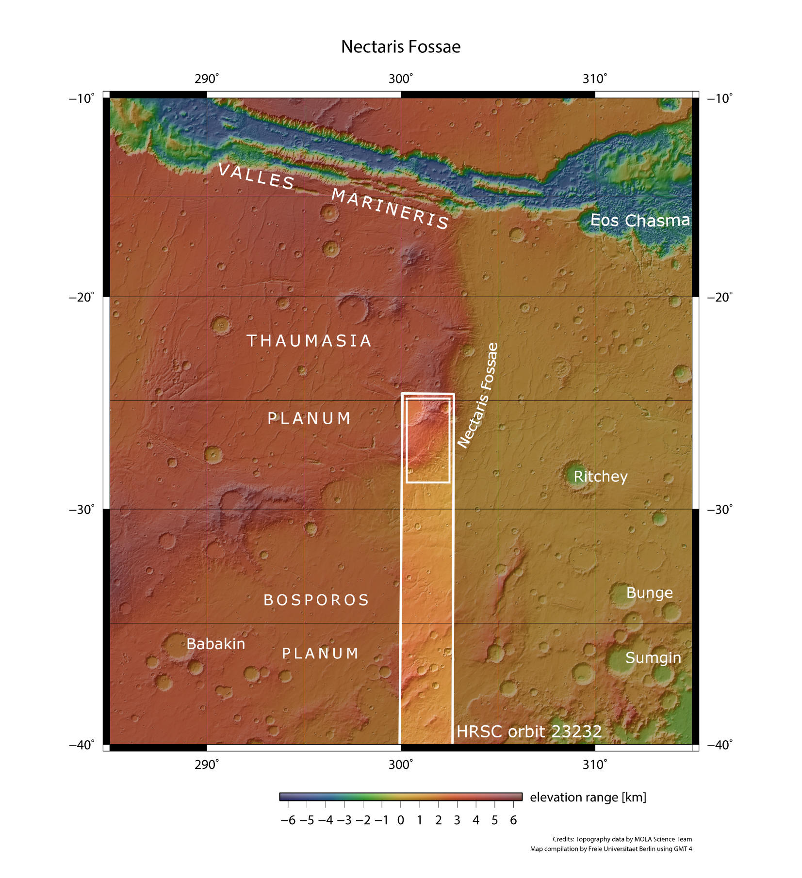
Nectaris Fossae - context map
Image Credit: MOLA Science Team/FU Berlin

Nectaris Fossae - 3D 1
Image Credit: ESA/DLR/FU Berlin

Nectaris Fossae - 3D 2
Image Credit: ESA/DLR/FU Berlin
Nectaris Fossae & Protva Valles • HRSC images

Nectaris Fossae - HRSC color-coded terrain model
Image Credit: ESA/DLR/FU Berlin

Nectaris Fossae - HRSC color image
Image Credit: ESA/DLR/FU Berlin

Nectaris Fossae - HRSC annotated
Image Credit: ESA/DLR/FU Berlin

Nectaris Fossae - HRSC anaglyph
Image Credit: ESA/DLR/FU Berlin
Nectaris Fossae & Protva Valles
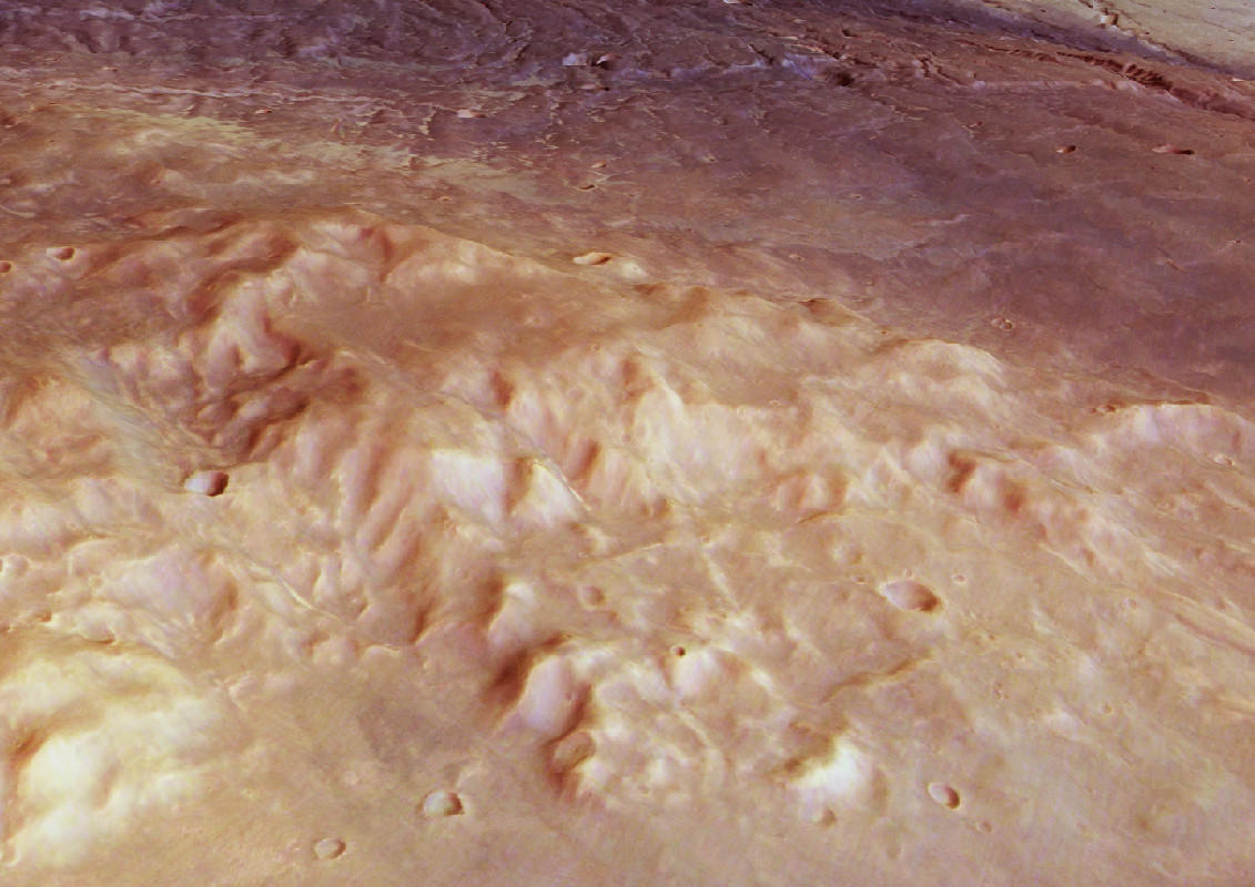
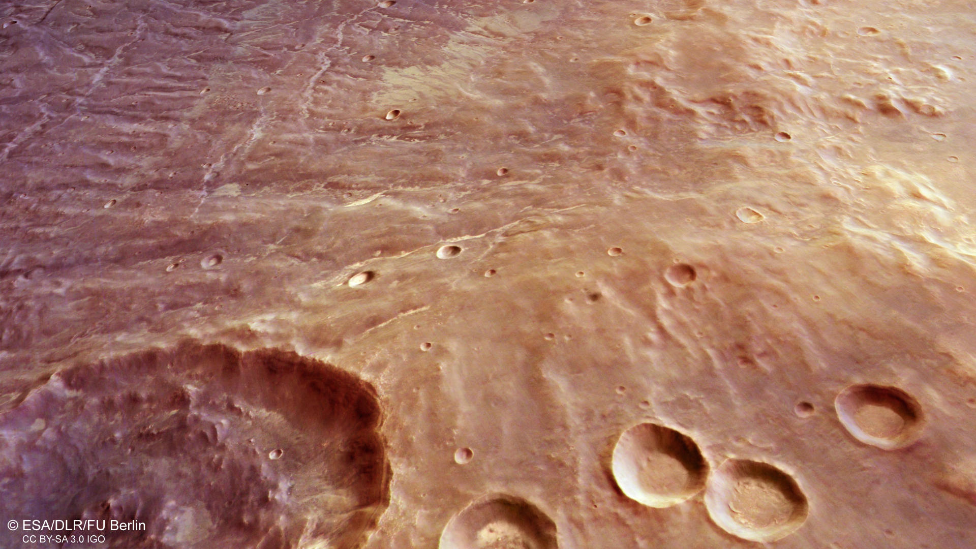
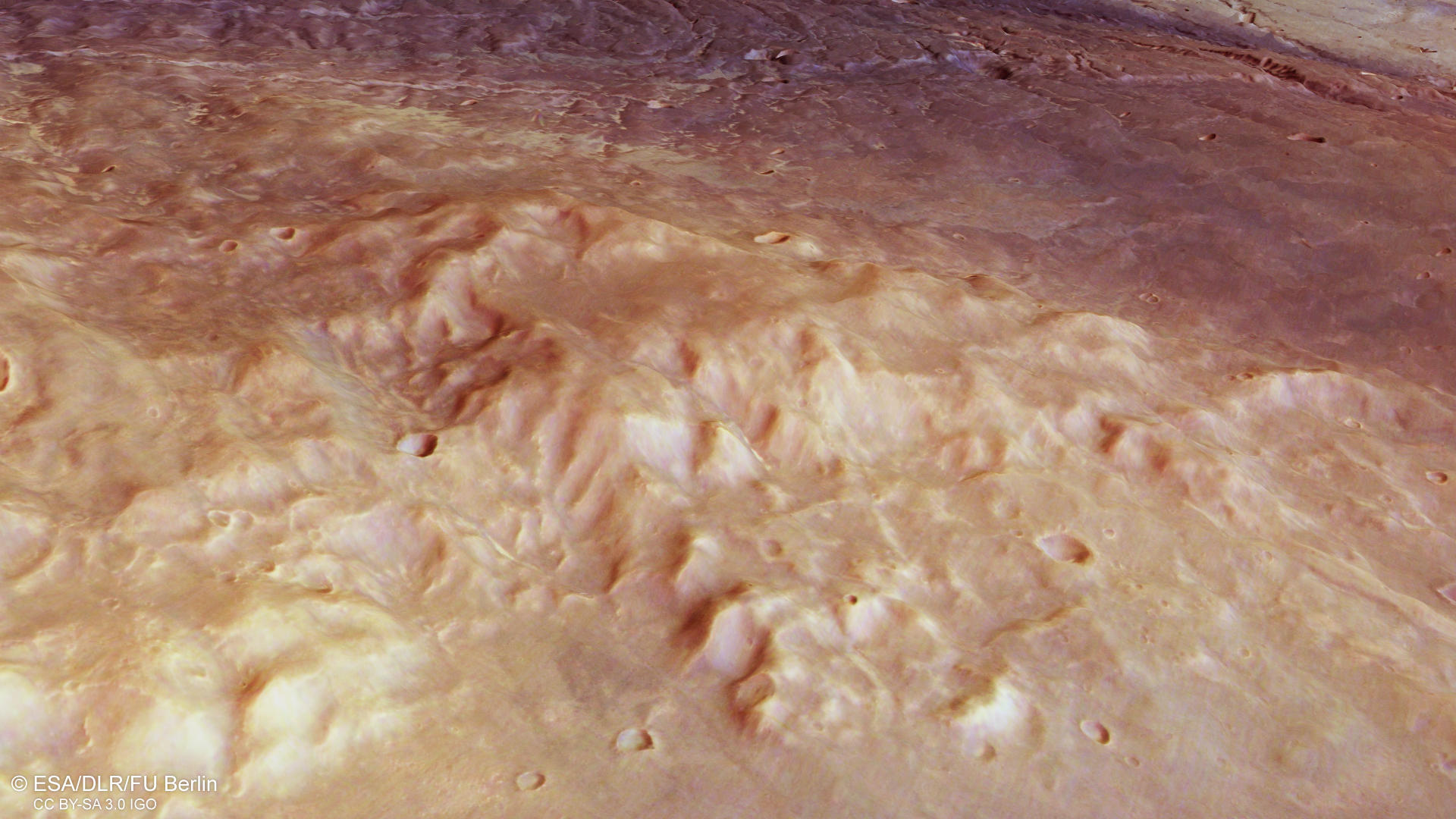
Thaumasia Planum is a large volcanic highland plateau, located south of Melas and Coprates Chasma which are part of the giant Vallis Marineris canyon system. It was named after a classical albedo feature and is made up largely of lava flows, at least several thousand meters thick. The flows date back to the Noachian, the oldest of the three Martian geologic time periods, and are about 4 billion years old. It borders to the east on a 900 km long north to northeast trending ridge, informally named Coprates rise.
The HRSC observation presented here shows the eastern flank of Coprates rise, containing tectonic features of the Nectaris Fossae fractures, as well as fluvial valleys Protova Valles. The topography is indicative of extensive reworking by tectonism and subsequent incision by valley networks. Some landforms on the surface are evidence of lava flows. Numerous wrinkle ridges can be spotted (see annotated image and overview map).
The formation of the Nectaris fossae began sometime in the Noachian and may have continued into the Late Hesperian period. It is believed to have a genetic relationship to the Valles Marineris System. In this HRSC observation, the fractures almost vertically cut through the image and are often filled with light toned dust.
The Protva Valles valley network is considerably degraded and was dated to the Late Noachian/Early Hesperian period, a time when much more water was available as runoff and could shape the surface by erosion.
The evolution of the region could have started with the load caused by the formation of the Tharsis volcanoes which caused stress, resulting in numerous fractures. Then, the region was repeatedly covered by basaltic lava flows. Wrinkle ridges formed as result of regional compression. In a later stage, the region was covered by volcanic ash and dust. Finally, the valleys were carved into the surface. It is unclear, where the waters came from. Some of the valleys appear to be incised deeper into the rock, others are more surficial and broader. They also appear to have their source at different height levels, which could be a hint to groundwater sapping. However, the intense erosion makes it difficult to assess the provenance of the waters. The height differences within this image are breathtaking 4500m! Since the formation of Protva Valles about 3.8 billion years ago, the geology has remained largely unchanged.
High Resolution Stereo Camera (HRSC)
The images were acquired by the HRSC (High Resolution Stereo Camera) on 23 May 2022 during Mars Express Orbit 23232. The ground resolution is approximately 23 meter per pixel and the images are centered at about 301° East and 27° South. The color image was created using data from the nadir channel, the field of view which is aligned perpendicular to the surface of Mars, and the color channels of the HRSC. The oblique perspective view was generated from the digital terrain model, the nadir and color channels of HRSC. The anaglyph image, which creates a three-dimensional impression of the landscape when viewed with red/blue or red/green glasses, was derived from the nadir channel and one stereo channel. The color-coded topographic view is based on a digital terrain model (DTM) of the region, from which the topography of the landscape can be derived. The reference body for the HRSC-DTM is a Mars equipotential surface (Areoid).
HRSC is a camera experiment that was developed and is operated by the German Aerospace Center (Deutsches Zentrum für Luft- und Raumfahrt; DLR).The systematic processing of the camera data took place at the DLR Institute for Planetary Research in Berlin-Adlershof. The working group of Planetary Science and Remote Sensing at Freie Universität Berlin used the data to create the image products shown here.
To download released raw images and DTMs of the region in GIS-ready formats, follow this link to the mapserver link:
Images: ESA/DLR/FU Berlin, CC BY-SA 3.0 IGO
Copyright Notice:
Where expressly stated, images are licenced under the Creative Commons Attribution-ShareAlike 3.0 IGO (CC BY-SA 3.0 IGO) licence. The user is allowed to reproduce, distribute, adapt, translate and publicly perform it, without explicit permission, provided that the content is accompanied by an acknowledgement that the source is credited as 'ESA/DLR/FU Berlin', a direct link to the licence text is provided and that it is clearly indicated if changes were made to the original content. Adaptation / translation / derivatives must be distributed under the same licence terms as this publication.
The High Resolution Stereo Camera was developed at the German Aerospace Center (DLR) and built in collaboration with partners in industry (EADS Astrium, Lewicki Microelectronic GmbH and Jena-Optronik GmbH). The science team, which is headed by Principal Investigator (PI) Dr. Thomas Roatsch, consists of 52 co-investigators from 34 institutions and 11 countries. The camera is operated by the DLR Institute of Planetary Research in Berlin-Adlershof.