Department of Earth Sciences
Service Navigation
Lycus Sulci – The wrinkled aureole of Olympus Mons
Image data, taken by the High Resolution Stereo Camera (HRSC) on board ESA’s Mars Express mission show a portion of the Lycus Sulci a part of the aureole surrounding Olympus Mons. HRSC is a camera experiment that was developed and is operated by the German Aerospace Center (Deutsches Zentrum für Luft- und Raumfahrt; DLR).
» read more in the main article below...
Lycus Sulci • Position & 3D view

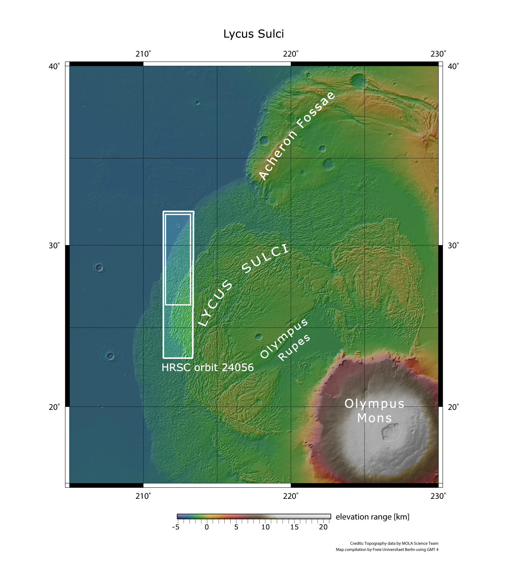
Lycus Sulci - context map
Image Credit: MOLA Science Team/FU Berlin

Lycus Sulci - 3D 1
Image Credit: ESA/DLR/FU Berlin

Lycus Sulci - 3D 3
Image Credit: ESA/DLR/FU Berlin

Lycus Sulci - 3D 3
Image Credit: ESA/DLR/FU Berlin
Lycus Sulci • HRSC images

Lycus Sulci - HRSC color-coded terrain model
Image Credit: ESA/DLR/FU Berlin

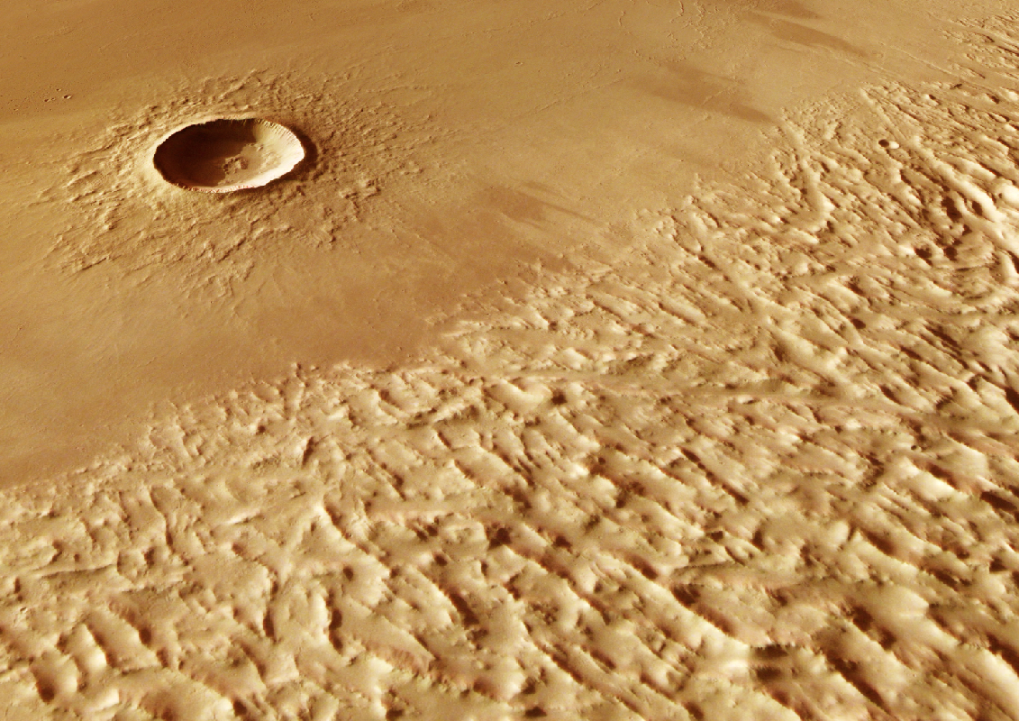
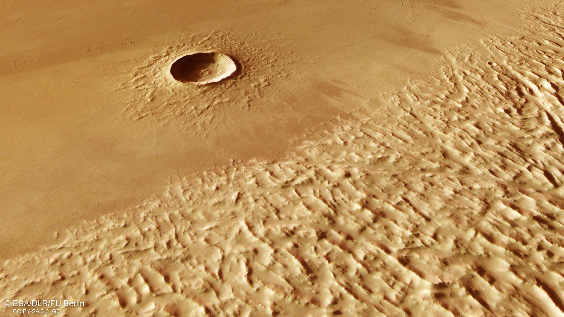
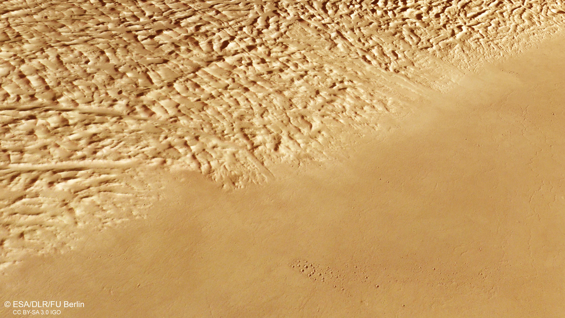
Lycus Sulci - HRSC color image
Image Credit: ESA/DLR/FU Berlin

Lycus Sulci - HRSC annotated
Image Credit: ESA/DLR/FU Berlin

Lycus Sulci - HRSC anaglyph
Image Credit: ESA/DLR/FU Berlin
Lycus Sulci
Shortly after the discovery of the giant shield volcano Olympus Mons on the Red Planet by the U.S. space probe Mariner 9 in 1971, planetary scientists had noticed that the volcano was surrounded by an aureole of very characteristic terrain. It extends over hundreds of kilometers into the surrounding area. The aureole tells the story of the catastrophic collapse of the lower flanks of Olympus Mons that occurred in its distant past.
Planetary scientists suspect that the landslides started several 100 million years ago, when large amounts of lava flowed down Olympus Mons. The flows probably deposited on bedrock that contained large amounts of water in the form of ice. The volcanic heat melted this ice, so that the rim areas of the volcano became unstable, broke off and partly slid away. During the collapse, huge rockfalls and landslides dropped from the lower slopes of the shield volcano over hundreds of kilometers of the surrounding volcanic plains. The characteristic crumpled appearance likely resulted during the landslide as material slid away from the volcano and became compressed or pulled apart as it travelled across the surface. Over time, wind erosion of weaker material between the peaks accentuated this effect. The hills and ridges are also covered by fine wind-blown dust. Single aureole landslides can be some hundred meters thick. Due to the superposition of several slides, thickness of more than 2000 m can be reached. This indicates, that multiple collapse events took place. These phases of activity can also be seen in the HRSC observation (see annotated image). Here, the deposit showing a large fracture is overlying the older landslide deposit which ends in the smooth plains.
Even today, Olympus Mons displays a high basal scarp, some of which rise up to seven kilometers above their surroundings (see overview map). Comparable Landslides, but on a much smaller scale, are also known from terrestrial volcanoes. For example, the volcanic islands of Hawaii and the Canary Islands are surrounded by such deposits of large rockfalls. Thus, the great similarity of the Martian volcanoes with their terrestrial counterparts becomes obvious here, if one disregards the dimensions of the Martian volcanos. Olympus Mons, with a height of 21.9 kilometers and a diameter of 600 kilometers, is the largest and highest mountain in the solar system. Another example: The 8.2 km Yelwa crater visible at the right (northern) part of the HRSC image is located incredible 1050 km northwest of the Olympus Mons caldera.
High Resolution Stereo Camera (HRSC)
The images were acquired by the HRSC (High Resolution Stereo Camera) on 18 January 2023 during Mars Express Orbits 24056. The ground resolution is approximately 19 meter per pixel and the image is centered at about 212° East and 28° North. The color image was created using data from the nadir channel, the field of view which is aligned perpendicular to the surface of Mars, and the color channels of the HRSC. The oblique perspective view was generated from the digital terrain model, the nadir and color channels of HRSC. The anaglyph image, which creates a three-dimensional impression of the landscape when viewed with red/blue or red/green glasses, was derived from the nadir channel and one stereo channel. The color-coded topographic view is based on a digital terrain model (DTM) of the region, from which the topography of the landscape can be derived. The reference body for the HRSC-DTM is a Mars equipotential surface (Areoid).
HRSC is a camera experiment that was developed and is operated by the German Aerospace Center (Deutsches Zentrum für Luft- und Raumfahrt; DLR). The systematic processing of the camera data took place at the DLR Institute for Planetary Research in Berlin-Adlershof. The working group of Planetary Science and Remote Sensing at Freie Universität Berlin used the data to create the image products shown here.
To download released raw images and DTMs of the region in GIS-ready formats, follow this link to the mapserver link:
Images: ESA/DLR/FU Berlin, CC BY-SA 3.0 IGO
Copyright Notice:
Where expressly stated, images are licenced under the Creative Commons Attribution-ShareAlike 3.0 IGO (CC BY-SA 3.0 IGO) licence. The user is allowed to reproduce, distribute, adapt, translate and publicly perform it, without explicit permission, provided that the content is accompanied by an acknowledgement that the source is credited as 'ESA/DLR/FU Berlin', a direct link to the licence text is provided and that it is clearly indicated if changes were made to the original content. Adaptation / translation / derivatives must be distributed under the same licence terms as this publication.
The High Resolution Stereo Camera was developed at the German Aerospace Center (DLR) and built in collaboration with partners in industry (EADS Astrium, Lewicki Microelectronic GmbH and Jena-Optronik GmbH). The science team, which is headed by Principal Investigator (PI) Dr. Thomas Roatsch, consists of 52 co-investigators from 34 institutions and 11 countries. The camera is operated by the DLR Institute of Planetary Research in Berlin-Adlershof.