Department of Earth Sciences
Service Navigation
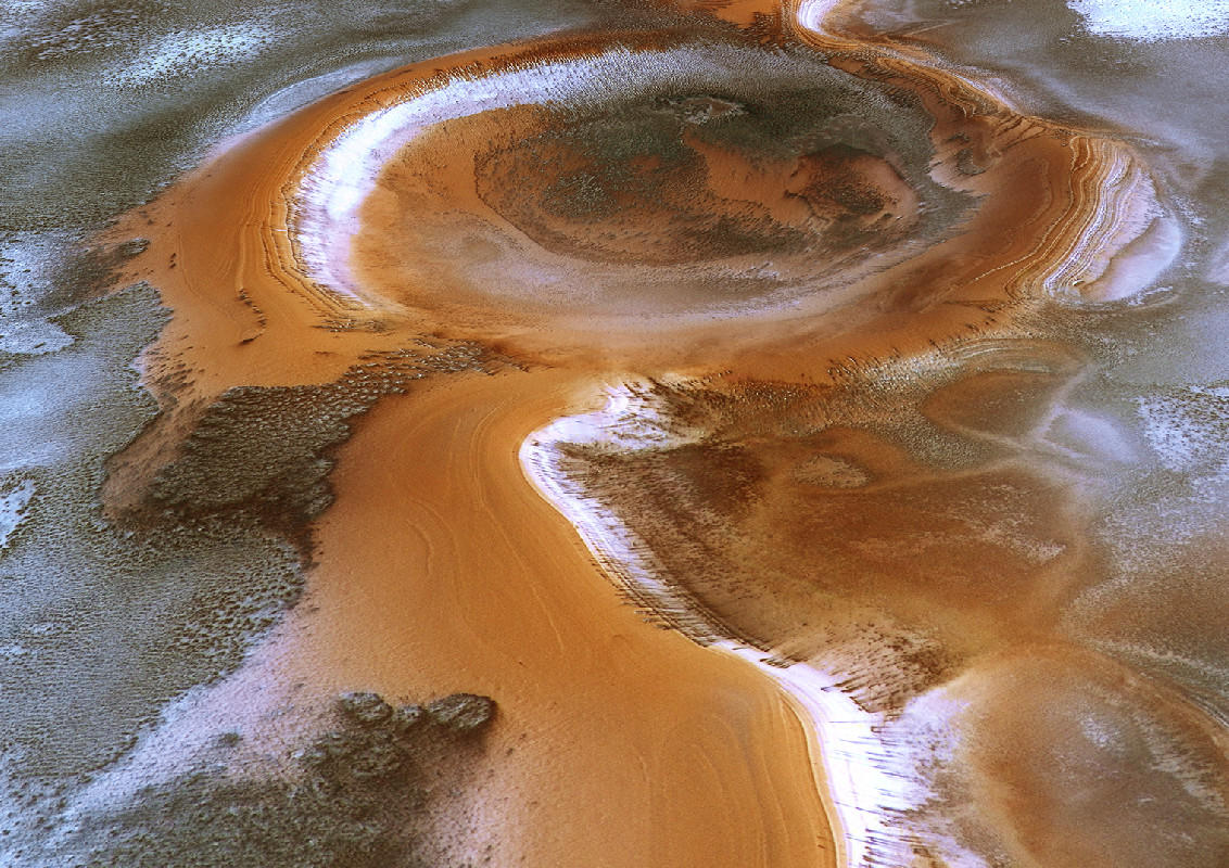
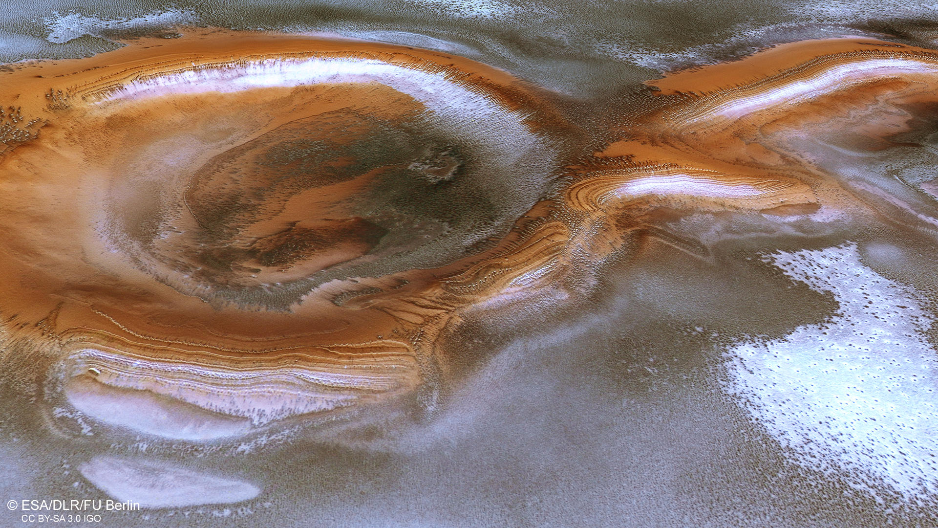
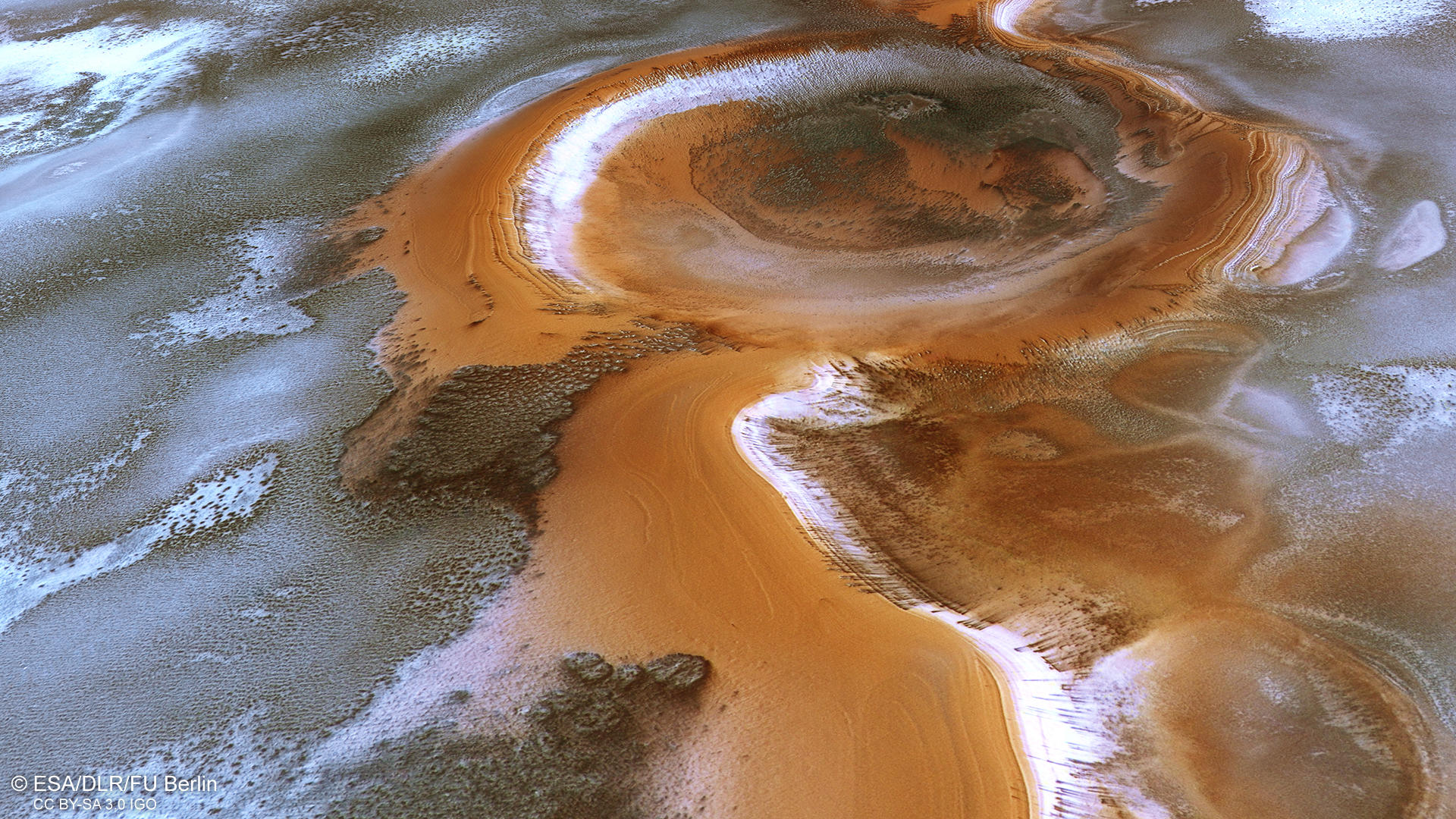
Ultimi Scopuli - Swirling Christmas Craterscape
Image data, taken by the High Resolution Stereo Camera (HRSC) on board ESA’s Mars Express mission show an exciting landscape of polar layered deposits, frost, ice and dark dunes in the south polar region of Mars. HRSC is a camera experiment that was developed and is operated by the German Aerospace Center (Deutsches Zentrum für Luft- und Raumfahrt; DLR).
Ultimi Scopuli • Position & 3D view

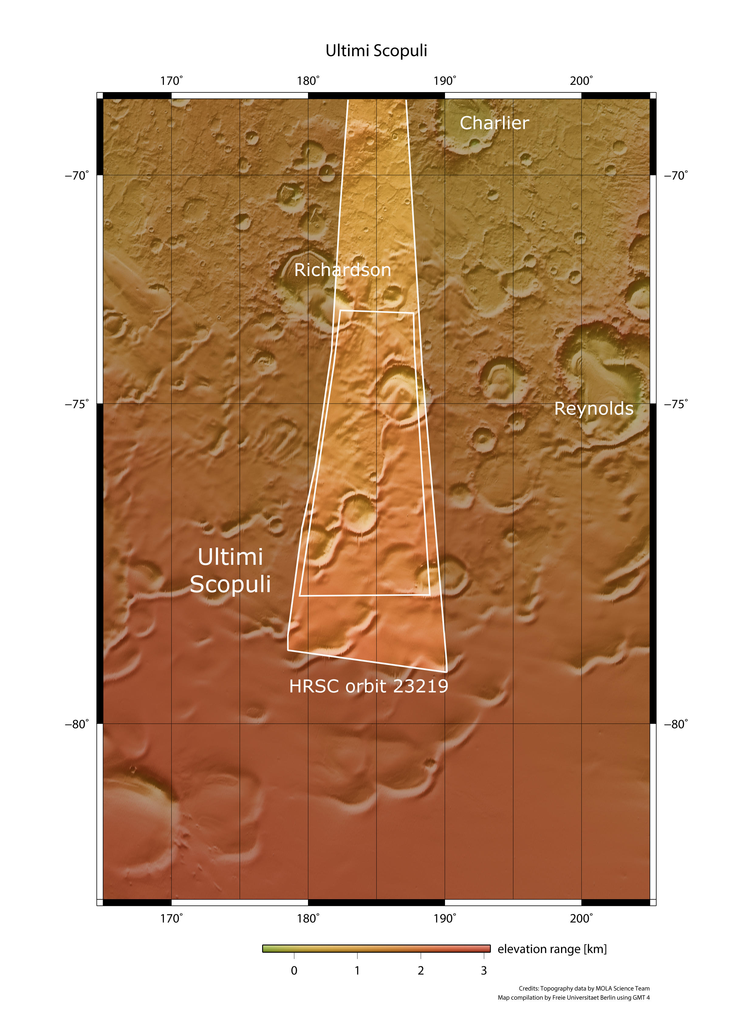
Ultimi Scopuli - context map
Image Credit: MOLA Science Team/FU Berlin

Ultimi Scopuli - 3D 1
Image Credit: ESA/DLR/FU Berlin

Ultimi Scopuli - 3D 2
Image Credit: ESA/DLR/FU Berlin
Ultimi Scopuli • HRSC images

Ultimi Scopuli - HRSC color-coded terrain model
Image Credit: ESA/DLR/FU Berlin

Ultimi Scopuli - HRSC color image
Image Credit: ESA/DLR/FU Berlin

Ultimi Scopuli - HRSC anaglyph
Image Credit: ESA/DLR/FU Berlin
Ultimi Scopuli - Swirling Christmas Craterscape
» read more about the Ultimi Scopuli region
This amazing image shows a lot of interesting periglacial landforms, as well as beautiful aeolian features and seasonal frost clouds. It was taken in southern spring, the time when the ice starts to retreat, leaving only a small residual ice cap at the south pole. During the Martian seasonal cycle, carbon dioxide ice is deposited at the poles in winter. The amount of atmosphere deposited as ice at each pole in winter and then sublimating in the springtime is enormous, reaching at least 12-16% of the atmosphere of the planet. This process leads to strong pressure changes and, as a consequence, to very high wind speeds.
The main two eye-catchers in the image are two large and old impact craters, which appear connected by a striped ribbon. This ribbon and the craters display a strong reddish-brown tone, which contrasts with the grey and white of the surrounding landscape, also, alternating layers are easily recognized. These are polar layered deposits, which are characterized by continuous sub-horizontal layers, they are mostly composed of water ice and of up to 10-15% fine sediments. The individual layers often differ from each other in their albedo, color, surface morphology and erosional texture. The polar layered deposits are formed by atmospheric fallout of dust and water ice and direct frost condensation. The orange colored regions in the image also reveal the layered nature of these deposits.
Many parts of the image display a hazy appearance, and especially in the central part some clouds can be spotted. Clouds in the south polar region often contain water ice and their trajectory is partly influenced by topography. All over the image numerous large sublimation structures can be found covering the surface and resembling terrestrial lakes. A very pronounced one in the upper left image border also appears to show tiny clouds at lower elevations.
All over the image, dark dunes and dune fields can be found, in some areas covered by a thin frost layer. Interestingly, the fields follow a yardang-like morphology indicating the prevalent wind directions, influenced by the morphology of the surface. The provenance of the dark material on Mars is still poorly understood. It is believed that it derives from ancient buried layers of volcanic eruption materials. It can be found globally all over Mars. In some regions, individual dark spots can be found in the image. These spots could be a hint at another distribution process of dark material, specific to polar areas on Mars: CO2 jets formed by sublimation beneath translucent ice slabs that then eject geyser-like fountains of dark dust. Constant monitoring of these zones helps to understand the processes that steadily alter the appearance of the surface in the polar regions on Mars.
High Resolution Stereo Camera (HRSC)
» information to image origin and processing
The images were acquired by the HRSC (High Resolution Stereo Camera) on 19 May 2022 during Mars Express Orbit 23219. The ground resolution is approximately 18 meters per pixel and the images are centered at about 185° East and 76° South. The color image was created using data from the nadir channel, the field of view which is aligned perpendicular to the surface of Mars, and the color channels of the HRSC. The oblique perspective view was generated from the digital terrain model, the nadir and color channels of HRSC. The anaglyph image, which creates a three-dimensional impression of the landscape when viewed with red/blue or red/green glasses, was derived from the nadir channel and one stereo channel. The color-coded topographic view is based on a digital terrain model (DTM) of the region, from which the topography of the landscape can be derived. The reference body for the HRSC-DTM is a Mars equipotential surface (Areoid).
HRSC is a camera experiment that was developed and is operated by the German Aerospace Center (Deutsches Zentrum für Luft- und Raumfahrt; DLR).The systematic processing of the camera data took place at the DLR Institute for Planetary Research in Berlin-Adlershof. The working group of Planetary Science and Remote Sensing at Freie Universität Berlin used the data to create the image products shown here.
To download released raw images and DTMs of the region in GIS-ready formats, follow this link to the mapserver.
Images: ESA/DLR/FU Berlin, CC BY-SA 3.0 IGO
Copyright Notice:
Where expressly stated, images are licenced under the Creative Commons Attribution-ShareAlike 3.0 IGO (CC BY-SA 3.0 IGO) licence. The user is allowed to reproduce, distribute, adapt, translate and publicly perform it, without explicit permission, provided that the content is accompanied by an acknowledgement that the source is credited as 'ESA/DLR/FU Berlin', a direct link to the licence text is provided and that it is clearly indicated if changes were made to the original content. Adaptation / translation / derivatives must be distributed under the same licence terms as this publication.
The High Resolution Stereo Camera was developed at the German Aerospace Center (DLR) and built in collaboration with partners in industry (EADS Astrium, Lewicki Microelectronic GmbH and Jena-Optronik GmbH). The science team, which is headed by Principal Investigator (PI) Dr. Thomas Roatsch, consists of 52 co-investigators from 34 institutions and 11 countries. The camera is operated by the DLR Institute of Planetary Research in Berlin-Adlershof.