Department of Earth Sciences
Service Navigation
Tantalus Fossae - Tantalizing Tectonics
Image data by the High Resolution Stereo Camera (HRSC) on board ESA’s Mars Express mission show a part of the large Tantalus Fossae fault system located east of the Alba Patera volcano. The High Resolution Stereo Camera (HRSC) is a camera experiment that was developed and is operated by the German Aerospace Center (Deutsches Zentrum für Luft- und Raumfahrt; DLR).
» read more in the main article and below the gallery about the Tantalus ...
Tantalus Fossae • Position & 3D view

Tantalus Fossae 3D
Image Credit: ESA/DLR/FU-Berlin

Tantalus Fossae 3D_2
Image Credit: ESA/DLR/FU-Berlin

Tantalus Fossae map
Image Credit: MOLA Science Team/FU Berlin
Tantalus Fossae HRSC images

Tantalus Fossae anaglyph
Image Credit: ESA/DLR/FU-Berlin

Tantalus Fossae color image
Image Credit: ESA/DLR/FU-Berlin

Tantalus Fossae color-coded terrain model
Image Credit: ESA/DLR/FU-Berlin
Tantalus Fossae – Tantalizing Tectonics
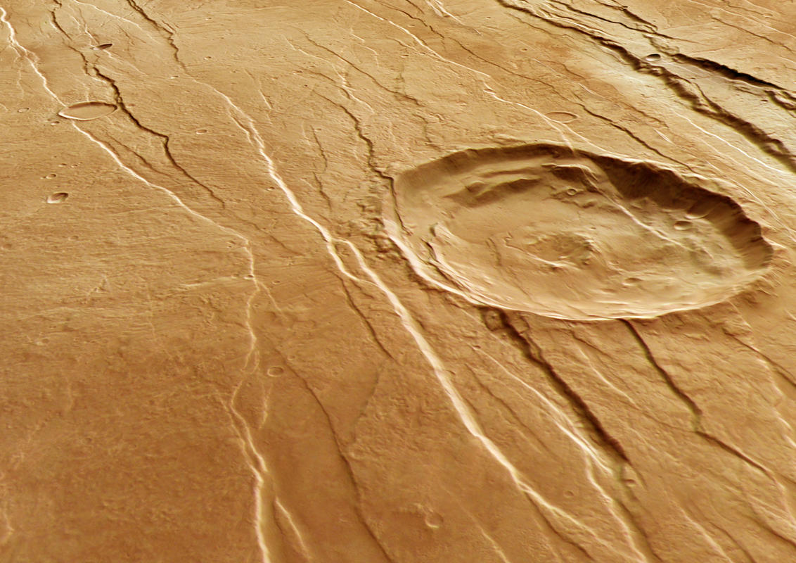
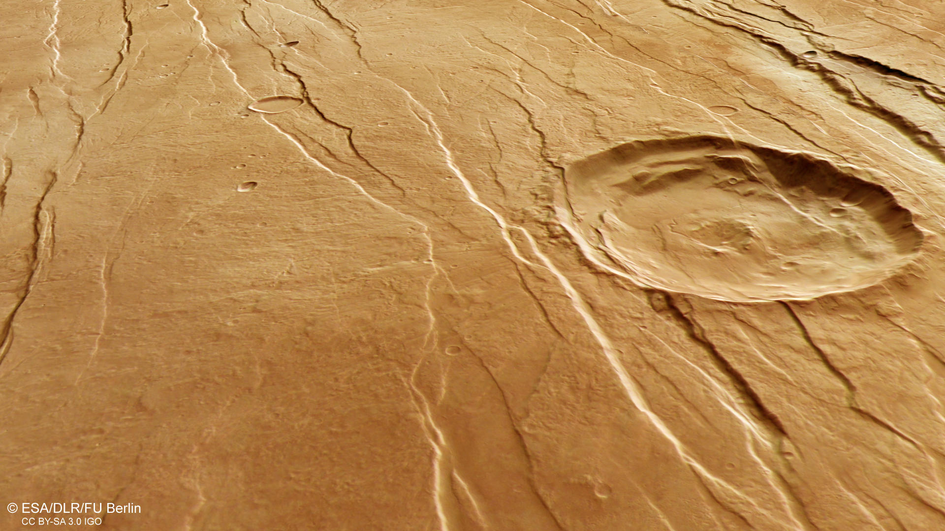
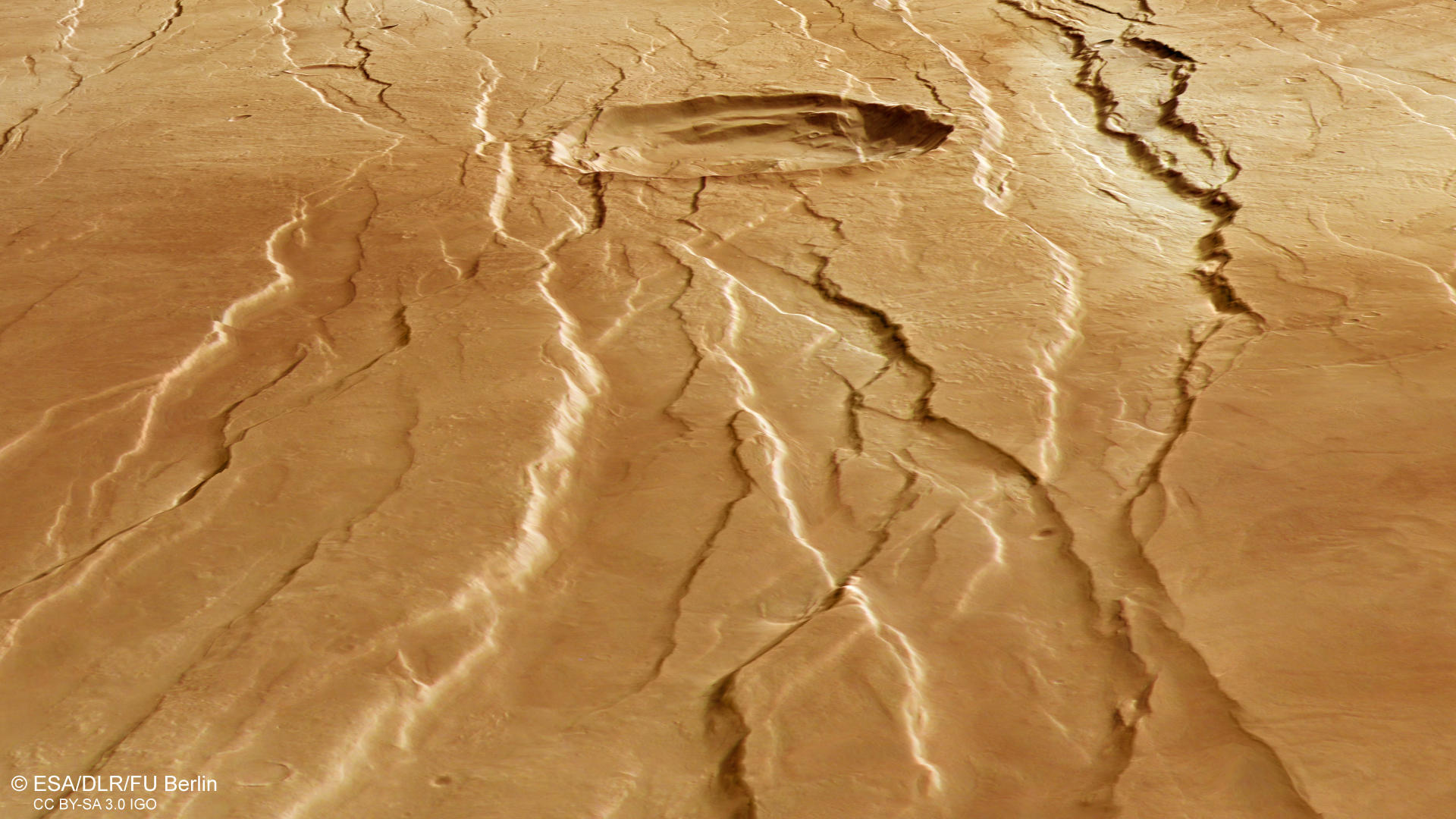
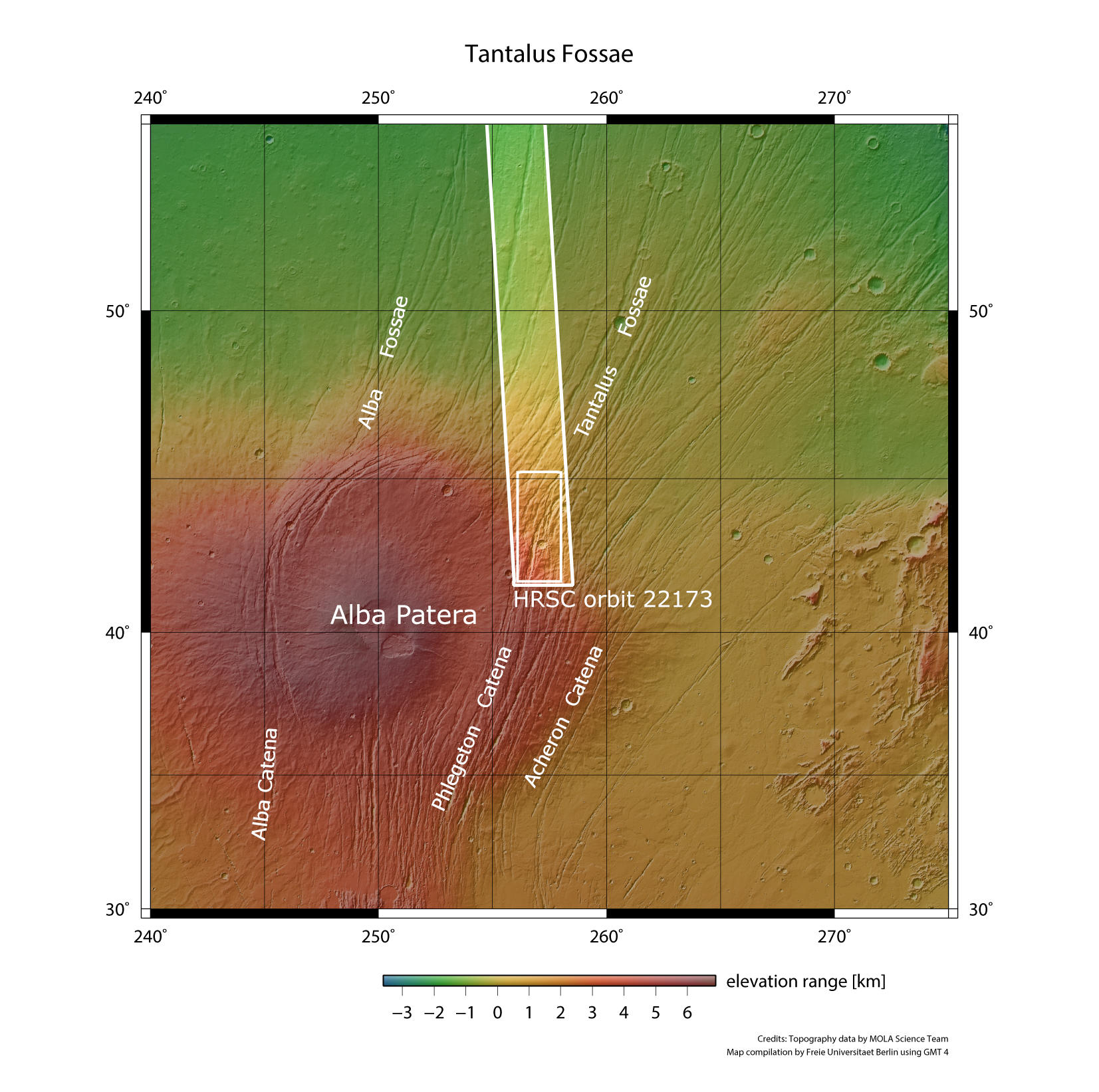
The Tantalus Fossae are a set of giant faults and fractures, located on the eastern side of Alba Patera in the Arcadia quadrangle. These faults are referred as grabens and the result of extensional forces associated with the uplift of the Alba Patera volcano. When the extension of the crust creates two parallel faults, the rock in between the faults drops down into the void created by the extension and forms a graben. The same features can also be found on the western side of Alba Patera, forming an incomplete ring around the volcano. Alba’s graben structures are up to 1000 km long and have a width of 2-10 km with depth ranging from 100 to 350 m.
Throughout the image we can spot numerous graben structures running roughly from the northeast to the southwest. These structures were not all created at the same time, but one after the other. This gives geologists the opportunity to reconstruct the events that created this astonishing landscape. The large impact crater in the image center for example is crosscut by some grabens which means, that it was already present before the volcano was uplifted what in consequence created the faults. The second largest, filled impact crater and many smaller ones, appear to superpose the faults and are therefore younger.
At closer look, a large network of small dendritic valleys can be found all over this HRSC observation. The valleys appear to be older than the graben structures because they were not deviated by the faults and appear to directly cut through them. This area is located on the flanks of the Alba Patera volcano and the northern (right) part of the image is located much deeper than the southern side. This can well be seen on the color-coded elevation model. Thus, these valleys should run along the slopes and merge in the deepest area. This can’t be observed at this location. The valleys must therefore originate from more ancient times.
The area is named after Tantalus, a son of Zeus and Pluto who, according to the legend, betrayed the gods and was sent to Hades where he was forced to stand in water underneath a fruit tree. When he tried to drink, the water retreated and when he tried to eat, the branches moved out of his reach. This punishment is known today as the torments of Tantalus.
High Resolution Stereo Camera (HRSC)
» information to image origin and processing
The images were acquired by the HRSC (High Resolution Stereo Camera) on 19 July 2021 during Mars Express Orbit 22173. The ground resolution is approximately 19 meters per pixel and the images are centered at about 257° East and 43° North. The color image was created using data from the nadir channel, the field of view which is aligned perpendicular to the surface of Mars, and the color channels of the HRSC. The anaglyph image, which creates a three-dimensional impression of the landscape when viewed with red/blue or red/green glasses, was derived from the nadir channel and one stereo channel. The oblique perspective view was generated from the digital terrain model, the nadir and color channels of HRSC. The color-coded topographic view is based on a digital terrain model (DTM) of the region, from which the topography of the landscape can be derived. The reference body for the HRSC-DTM is a Mars equipotential surface (Areoid).
HRSC is a camera experiment that was developed and is operated by the German Aerospace Center (Deutsches Zentrum für Luft- und Raumfahrt; DLR).The systematic processing of the camera data took place at the DLR Institute for Planetary Research in Berlin-Adlershof. The working group of Planetary Science and Remote Sensing at Freie Universität Berlin used the data to create the image products shown here.
To download released raw images and DTMs of the region in GIS-ready formats, follow this link to the mapserver.
Images: ESA/DLR/FU Berlin, CC BY-SA 3.0 IGO
Copyright Notice:
Where expressly stated, images are licenced under the Creative Commons Attribution-ShareAlike 3.0 IGO (CC BY-SA 3.0 IGO) licence. The user is allowed to reproduce, distribute, adapt, translate and publicly perform it, without explicit permission, provided that the content is accompanied by an acknowledgement that the source is credited as 'ESA/DLR/FU Berlin', a direct link to the licence text is provided and that it is clearly indicated if changes were made to the original content. Adaptation / translation / derivatives must be distributed under the same licence terms as this publication.
The High Resolution Stereo Camera was developed at the German Aerospace Center (DLR) and built in collaboration with partners in industry (EADS Astrium, Lewicki Microelectronic GmbH and Jena-Optronik GmbH). The science team, which is headed by Principal Investigator (PI) Dr. Thomas Roatsch, consists of 52 co-investigators from 34 institutions and 11 countries. The camera is operated by the DLR Institute of Planetary Research in Berlin-Adlershof.