Springe direkt zu Inhalt

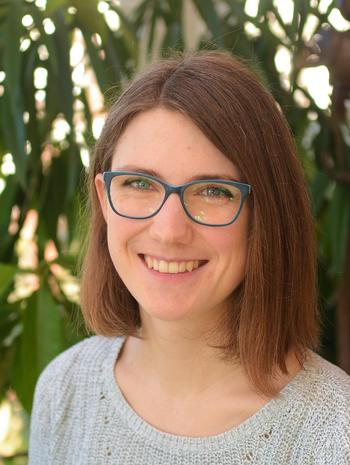
Miriam Herrmann

Miriam_Herrmann_HP

Institute of Geographical Sciences

Remote Sensing and Geoinformatics

Researcher

Address
Malteserstraße 74-100
12249 Berlin
Email
miriam.herrmann[at]fu-berlin.de

Office hours

Sprechstunde: nach Vereinbarung
Office hour: by appointment

Pronomen/Pronouns: sie/ihr - she/her

Short CV

since 03/2023: PhD student, Free University of Berlin

10/2015 - 12/2022: BSc. and MSc. Geoecology
At the Karlsruhe Institute of Technology (KIT), Institute of Geography and Geoecology (IFGG), Karlsruhe, Germany,
specializing in: Ecosystem Management, Geobotany, Remote Sensing

10/2019 - 11/2022: Supplementary Studies on Sustainable Development
At KIT, Zentrum für Angewandte Kulturwissenschaften und Studium Generale (ZAK), Karlsruhe, Germany,
specializing in: Sustainability in culture and society, Personal Sustainability

01/2021 - 11/2022: Assistant in environmental planning
At “Emch+Berger Umwelt und Landschaftsplanung”, Karlsruhe, Germany

12/2017 - 02/2018: Student collaborator
At the Institute of Applied Geosciences, KIT, Germany

OrcID: 0009-0003-1179-8361

ResearchGate

I am fascinated by the ways vegetation interacts with and shapes its environment. My research focuses on forest structure and how modern remote sensing methods can help us better understand ecosystem processes. Using terrestrial laser scanning and three-dimensional forest data, I investigate how forests are organized in space and how this information can be linked to real-world challenges. Applications range from estimating fuel loads for wildfire prediction and prevention to forest inventories used to assess biomass, carbon storage, and structural diversity.

Background

With a background in geoecology, plant ecology, and remote sensing, I currently pursue these questions as a PhD researcher in the Remote Sensing and Geoinformatics group at Freie Universität Berlin.

While I spend much of my time analyzing point clouds and spatial data, some of my favorite moments in research happen during field campaigns, collecting data with our terrestrial laser scanner, a Riegl VZ-400i.

And for those interested in the technical side: my favorite R packages are sf, lidR, and ggplot2.

Refereed Journal Papers

Herrmann, M., Schmidt-Riese, E., Cabo, C., Derethal, M., Stellmes, M., & Fassnacht, E. (under review). Modeling surface fuel loads in temperate oak and pine forests using 3D structural metrics from terrestrial laser scanning.

Herrmann, M., Derenthal, M., Schmidt-Riese, E. Stellmes, M., Janoutová, R., Arendholz, F., Bäte, D. A., Ernst, J., Fakhri, A., Jaki, P., Katerndahl, F., Kempfer, F., Mansi, C., Meindl, J., Navrátilová, B., Plewnia, F., Ruhtz, T., Scholl, M., Waseem, A., Fassnacht, F., (under review). Standardized terrestrial laser scanning dataset of forests: 3D point clouds and tree-level attributes from 121 plots across five European regions.

Laino, D., Cabo, C., Ordóñez, C., Bolanos, R., Janvier, R., Giulioni, F., Herrmann, M., Hudak, A., Parsons, R., & Santin, C. (2026). SegmentedForests: a labelled dataset of terrestrial LiDAR point clouds for semantic segmentation of forests. Forestry: An International Journal of Forest Research, 99(2), cpaf062, https://doi.org/10.1093/forestry/cpag032

Herrmann, M., Schmidt-Riese, E., Bäte, D. A., Kempfer, F., Fassnacht, F. E., & Egger, G. (2024). Satellite-observed flood indicators are related to riparian vegetation communities. Ecological Indicators, 166, 112313, https://doi.org/10.1093/forestry/cpaf062

Conference Contributions

Herrmann, M., Cabo, C., Fassnacht, F. (2025). From Point Clouds to Fuel Maps, Modeling Surface Fuels from 3D Terrestrial Lidar Data. Poster presented at the Living Planet Symposium, Vienna, Austria.

Herrmann, M., Cabo, C., Fassnacht, F. (2025). From Point Clouds to Fuel Maps: Modeling Surface Fuels from 3D Terrestrial Lidar Data. Oral presentation at the 44th EARSeL Symposium, Prague, Czech Republic.

Herrmann, M., Cabo, C., Fassnacht, F. (2024). Mapping surface fuels in three-dimensional space using terrestrial laser scanning and RBG image mosaics. Poster presented at the 26th IUFRO World Congress, Stockholm, Sweden.

Herrmann, M., Stellmes, M., Fassnacht, F. (2023). Surface fuel mapping using terrestrial laser scanning. Poster presented at SilviLaser, London, Great Britain.

Selected Data

Herrmann, M., Derenthal, M., Schmidt-Riese, E. Stellmes, M., Arendholz, F., Bäte, D. A., Ernst, J., Fakhri, A., Jaki, P., Janoutová, R., Katerndahl, F., Kempfer, F., Mansi, C., Meindl, J., Navrátilová, B., Plewnia, F., Ruhtz, T., Scholl, M., Waseem, A., Fassnacht, F. (2026). Harmonized terrestrial laser scanning forest dataset: 3D point clouds and tree-level attributes from five campaigns in Europe. doi:10.5281/ZENODO.18670608.