Meteorological modelling over the Po Valles and Lombardy Region
POMI - Meteorological modelling over the Po Valley and Lombardy Region
European Commission, Joint Research Centre, No. D/7701
Summary
For the Po Valley Model Intercomparison exercise (POMI) we use the meteorological driver TRAMPER, which is adapted to our Chemistry Transport Model REM-Calgrid.
The REM-Calgrid Model is an urban/regional scale model development designed to fulfill the requirements of the ambient air qualityframework directive 96/62/EC of the European Commission. TRAMPER incorporates an numerical statistical fine mesh analysis procedure for meteorological observations from weather services and all available local measurements and is used and improved for a longer time. The analysis system can be combined with meteorological forecast data in a medium complex way of assimilation.
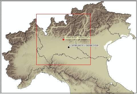
For the Po Valley and Lombardy Region as given in the map above the following steps will be performed for the year 2005:
- The forecast model data from the Local Model from DWD (LM) with the grid size of 7 km will be prepared and transformed to isentropic surfaces including all parameters needed.
- The observations of weather services available at Institut of Meteorology at FU Berlin are prepared for analysis.
- Additional observational data from Northern Italy and Switzerland will be prepared.
- The TRAMPER system will be applied to these data sets preparing 5 km and 2.5 km gridded parameter fields by correction of the forecast model data.
- The analysed data will be transformed to sigma coordinate.
- For evaluation the output will be compared to all observations and the analysis errors depending on grid size and density of observations. The general error statistics in space and time and local time series will be presented.
- Within the analysis procedure the direct comparison to the forecast model output from LM to the observations is prepared and used for interpolation. These statistics will be presented in addition to give information about the local forecast errors from LM and the adjustment process to the observation.