Gather and analyse data and information
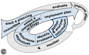
Gather and analyse information
Image Credit: Anette Stumptner 2007
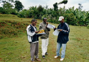
Mapping of several characteristics of the Gina River catchment, Ethiopie during a field seminar 2003
Image Credit: Eck, J. 2003
After a planning committee is elected it can start to produce a Watershed Management Plan. The first step is to gather and analyse information about the watershed (see figure). The effectiveness of Watershed Management depends on a comprehensive understanding of all individual components of and processes within the ecosystem as well as their interdependence and interconnections [11]. A comprehensive analysis of the underlying natural and socio-economic attributes of the watershed is the basis for the development of a watershed management strategy (planning goal) (Heathcote 1998). This includes
- gathering and compiling existing information and data; in most cases reports, statistics and maps of soil surveys, geologic surveys, forest inventories and hydro-meteorologic as well as socio-economic studies that are mostly already available in government agencies;
- confirmation and completion of data during field survey if necessary [10].
A central file of relevant reports, records and maps should be created and routinely updated. An important tool is a Geographical Information System (GIS) into which the data can be integrated.
The gathered and analysed data can reveal different problems within the watershed that have to be identified in the next stage of the planning process.


