The iMars webGIS
European Union’s Seventh Framework Programme FP7
under grant agreement no. 607379
The iMars project focuses on developing a user platform for Mars surface science, consisting of a consistent set of data products of Mars from the 1970s to the present day. The concept aims to generate a webGIS using imaging data from NASA and ESA missions; including specific tools for producing, exploring and analyzing data products for studies of surface changes over time.
Planetary surface science has seen a dramatic increase in both quality and quantity of observations over the last decades, especially in 3D imaging. The EU funded iMars-project has started in 2014 and aims to generate an automated processing system which allows to study this large volume of multi-type observation data from different epochs. It is anticipated that the entire NASA and ESA record of Martian orbital image data will be collected within a single environment for handling, visualisation and subsequent analyses. Such analyses will be conducted automatically using change-detection algorithms or interactively using the citizen-science concept implemented at Zooniverse.
Close user interaction plays a paramount role within iMars which requires sophisticated concepts for data handling and communication. This interactive data hub will be realised through open-source webGIS implementations and by providing webGIS services to the user community using established OGC-protocols.
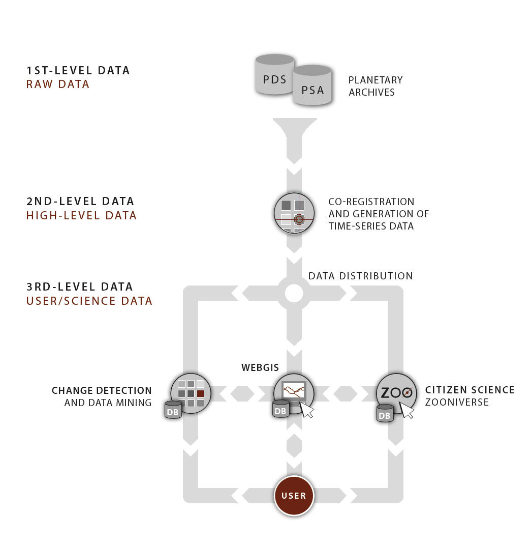
General project workflow from unprocessed raw data (1) to higher level science data (2) and results obtained from citizen science (3). The iMars webGIS is the central hub which integrates higher-level co-registered data products as well as results from user analysis. (Figure: S. van Gasselt © 2014)
For planetary data only a few web-based GIS have been implemented during the last decade and even fewer can be considered as being established in and accepted by the user community. Most web-based services today are either archive systems as realised in the Planetary Data System (PDS) and the Planetary Science Archive (PSA) nodes. Web-based services are map-focussed systems targeted at visualisation rather than ancillary data and metadata access (e.g., Google Mars).
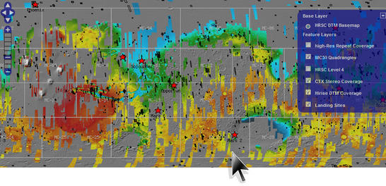
The developing of iMars-webGIS includes the combination of co-registered, terrain-corrected and multi-temporal Martian imaging data and specific higher-level tools within a single map-focused information system. This platform will allow to navigate data intuitively and conveniently; to discover what and where surface changes have occurred since the mid-1970s.