Orbit 25000 - Picture Perfect
Image data, taken by the High Resolution Stereo Camera (HRSC) on board ESA’s Mars Express show a fantastic high-altitude view of Mars including its moon Phobos. HRSC is a camera experiment that was developed and is operated by the German Aerospace Center (Deutsches Zentrum für Luft- und Raumfahrt; DLR).
» read more in the main article below...
Orbit 25000 • Position & 3D view

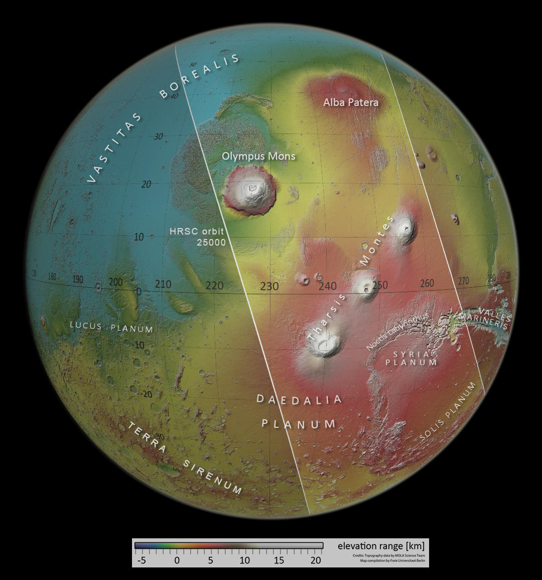
Orbit 25000 - Color-coded Context Map
Image Credit: MOLA Science Team/FU Berlin

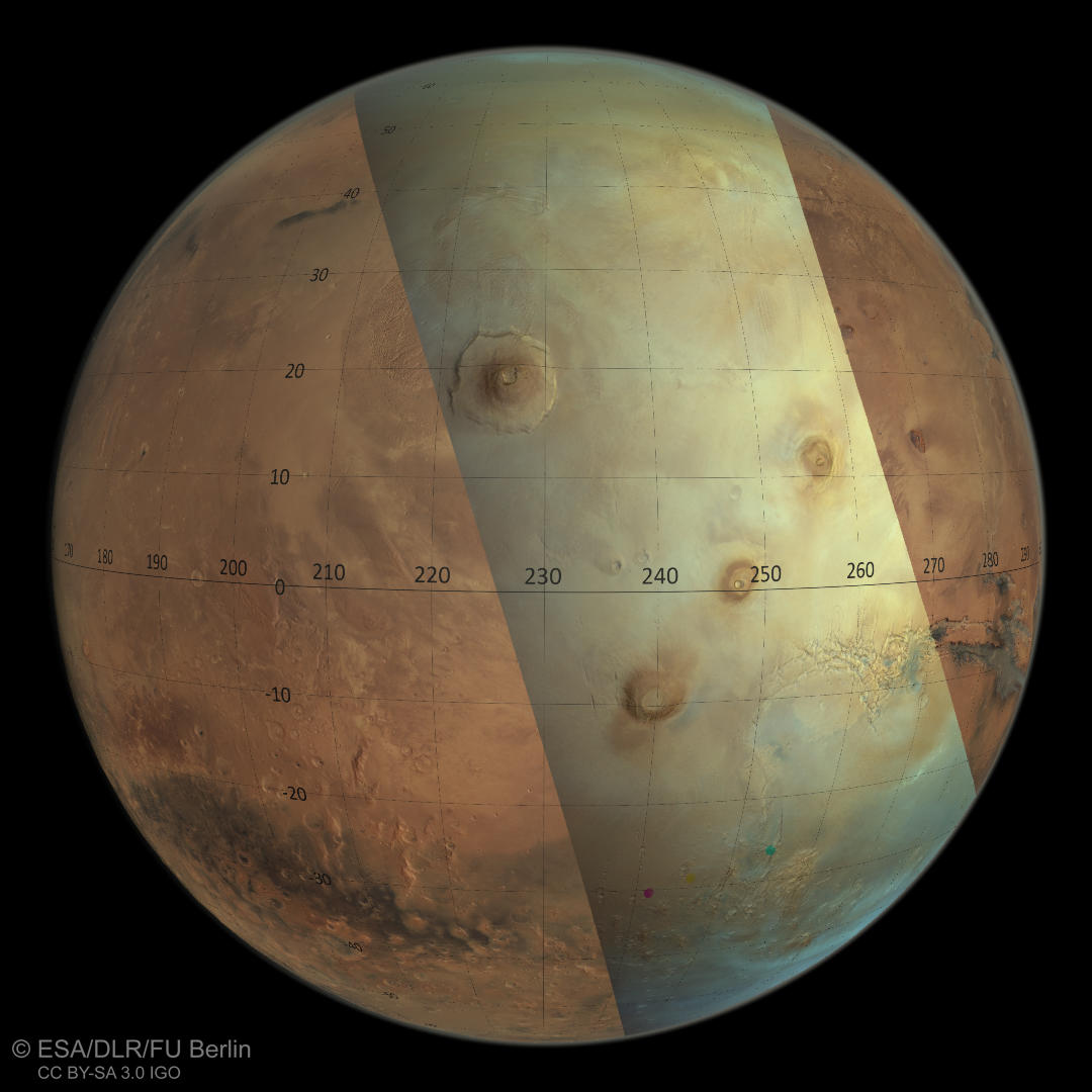
Orbit 25000 - HRSC-color Overview Map
Image Credit: ESA/DLR/FU Berlin

Orbit 25000 - HRSC/MOLA 3D 1
Image Credit: ESA/DLR/FU Berlin/MOLA Science Team

Orbit 25000 - HRSC/MOLA 3D 2
Image Credit: ESA/DLR/FU Berlin/MOLA Science Team
Orbit 25000 • HRSC images

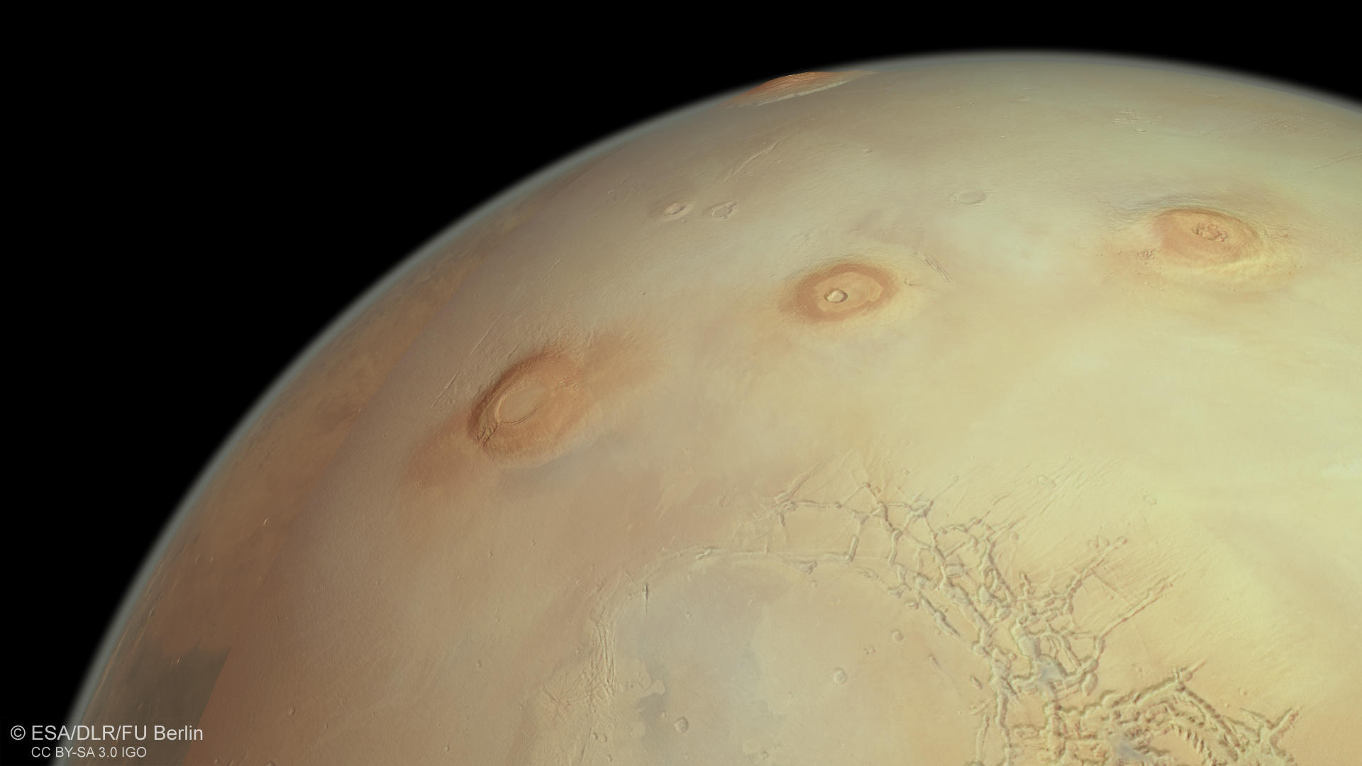
Orbit 25000 - HRSC Color
Image Credit: ESA/DLR/FU Berlin

Orbit 25000 - HRSC/MOLA Anaglyph
Image Credit: ESA/DLR/FU Berlin/MOLA Science Team

Orbit 25000 - HRSC Annotated
Image Credit: ESA/DLR/FU Berlin
Orbit 25000 - Picture Perfect
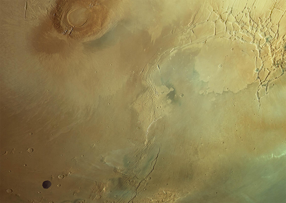
Orbit 25.000 of Mars Express could not have been pictured in a more spectacular scene than in this fantastic high-altitude observation of the HRSC camera. The image provides a rare look not only at several large Martian volcanoes in the Tharsis volcanic province but also shows the Martian moon Phobos passing by!
The Tharsis region covers one quarter of the Martian surface. Even the smaller volcanos like Jovis Tholus, Biblis and Ulysses patera can be found in the image. The fractured Noctis Labyrinthus canyons can be easily spotted, as are many other surface features observed in previous orbits, like for example the large Lycus Sulci landslide north of Olympus Mons or the Tantalus Fossae in the upper portion of the image. Check the annotated image for prominent features and use the zoom function to further explore this high-resolution image. In the lower portion of the image, a small cloud band and lee wave clouds can be found. The latter develop when air passes over an obstacle like a topographic ridge and receives a pulse which is then transformed into kinetic energy. The stack of air, consisting of different layers, then forms a wave-like structure at the lee side of the obstacle.
Mars Express has a polar orbit and the spacecraft travels on elongated ellipses. During each seven-hour orbit, the spacecraft approaches the surface to about 300 km and then moves away to a distance of about 10.000 km. Images from this high altitude are typically obtained to observe weather patterns, for creating global views of the surface and for calibration purpose. The sensors of the HRSC are directed over a wide extended area in a sweeping movement. That is why this type of observation is also called 'broom calibration'. The field of view of the line sensors that are arranged perpendicular to the flight path are pushed across the surface like a broad 'brush stroke'. In this way, all the sensors scan the surface at the same angle of observation one after the other, resulting in a time interval. This becomes visible in the color overview image (Mars with grid), where Phobos can be spotted at different locations because it moved on during the scan process. In the post-processing for such images as presented here, the individual color images are then overlain to create the full color view. Phobos was individually reconstructed to give a consistent impression of the scene.
High Resolution Stereo Camera (HRSC)
The images were acquired by the HRSC (High Resolution Stereo Camera) on 19 October 2023 during Mars Express Orbits 25000. The ground resolution is approximately 450 meters per pixel and the image is centered at about 248° East and 2° North. The color image was created using data from the nadir channel, the field of view which is aligned perpendicular to the surface of Mars, and the color channels of the HRSC. The context maps are based on HRSC data and data of the of the Mars Orbiter Laser Altimeter (MOLA) experiment onboard the Mars Global Surveyor (MGS) mission of NASA. The oblique perspective view was generated from a MOLA digital terrain model with an exaggeration factor of roughly 3 and the color channels of HRSC. The anaglyph image, which creates a three-dimensional impression of the landscape when viewed with red/blue or red/green glasses, was derived from the MOLA digital terrain model information and from the nadir channel.
HRSC is a camera experiment that was developed and is operated by the German Aerospace Center (Deutsches Zentrum für Luft- und Raumfahrt; DLR). The systematic processing of the camera data took place at the DLR Institute for Planetary Research in Berlin-Adlershof. The working group of Planetary Science and Remote Sensing at Freie Universität Berlin used the data to create the image products shown here.
To download released raw images and DTMs of the region in GIS-ready formats, follow this link to the mapserver.
Images: ESA/DLR/FU Berlin, CC BY-SA 3.0 IGO
Copyright Notice:
Where expressly stated, images are licenced under the Creative Commons Attribution-ShareAlike 3.0 IGO (CC BY-SA 3.0 IGO) licence. The user is allowed to reproduce, distribute, adapt, translate and publicly perform it, without explicit permission, provided that the content is accompanied by an acknowledgement that the source is credited as 'ESA/DLR/FU Berlin', a direct link to the licence text is provided and that it is clearly indicated if changes were made to the original content. Adaptation / translation / derivatives must be distributed under the same licence terms as this publication.
The High Resolution Stereo Camera was developed at the German Aerospace Center (DLR) and built in collaboration with partners in industry (EADS Astrium, Lewicki Microelectronic GmbH and Jena-Optronik GmbH). The science team, which is headed by Principal Investigator (PI) Dr. Daniela Tirsch, consists of 52 co-investigators from 34 institutions and 11 countries. The camera is operated by the DLR Institute of Planetary Research in Berlin-Adlershof.