figure_tank-irrigated-landscape
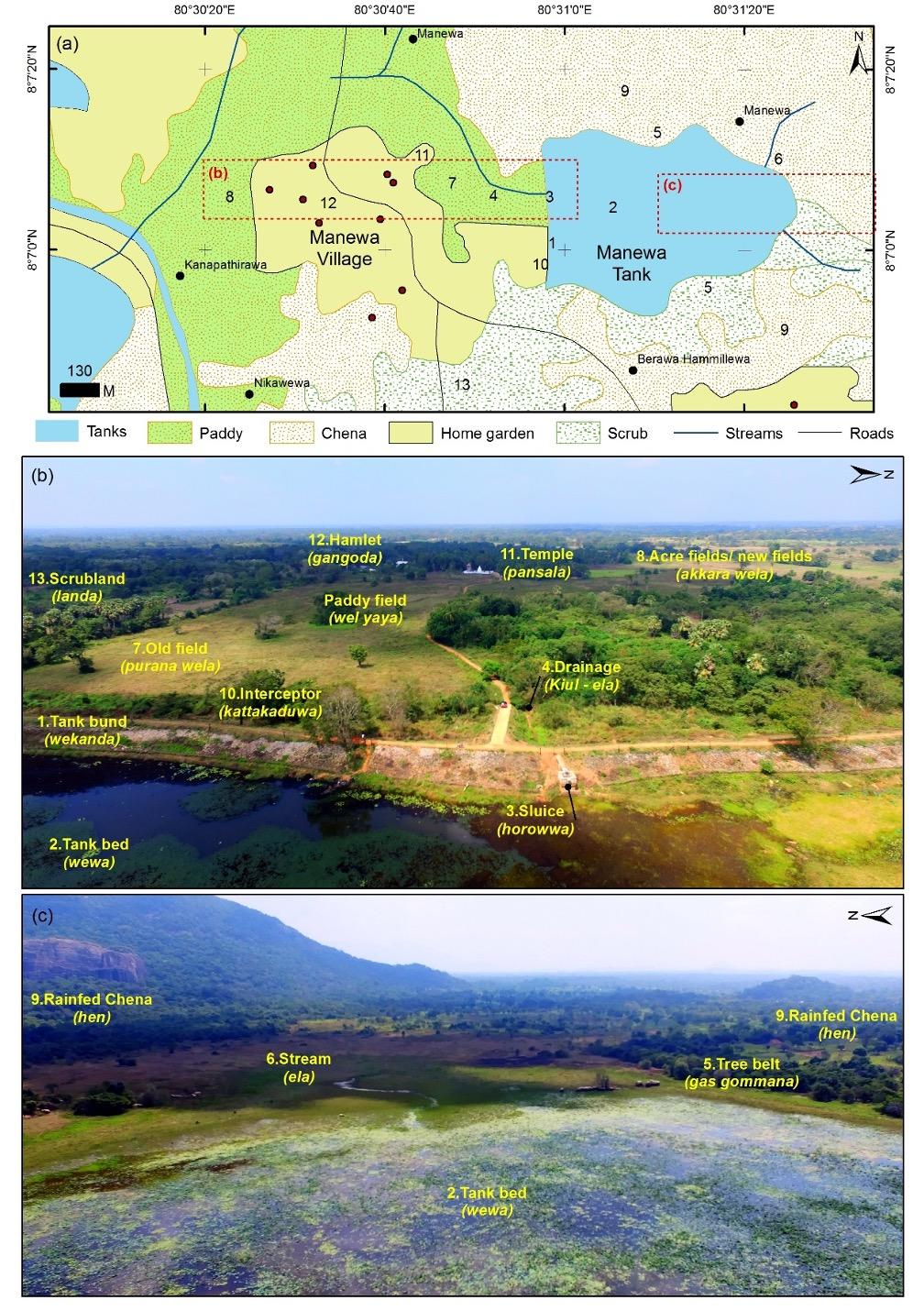
Bildquelle: (a) Land use map of Manewa village compiled using the 1:50,000 topographic data of the survey department and streams calculated with ArcGIS using the flow accumulation for Landsat DEM (USGS 2017); (b, c) Drone photographs showing the main components of the Manewa irrigated landscape (photographs taken by Indika Alahakoon in January 2018). Segment names were assigned after remodelling Dharmasena 2010 (Dharmasena, 2010b) with field observations and discussions with local farmers. (Respective numbers in the land-use map refer to the different elements shown in the photographs.)