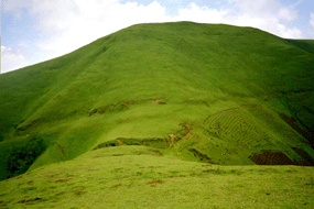
Morphosphere of the Gina River catchment
The morphosphere of the Gina River catchment is characterised by the following attributes:
- The altitudes in the drainage basin range from 2400 m a.s.l. to 3200 m a.s.l. in its headwater areas.
- Most of the area lies at altitudes between 2700 m a.s.l. and 2900 m a.s.l.
- The Gina River catchment has a north-west – south-east alignment.
- The Gina River catchment can be divided into 5 regions (Beck et al. 2004).
- The two most important morphological processes are soil erosion and mass movements.
Delineation of morphological units
On the basis of a field survey and a Digital Elevation Model (DEM), different morphological units can be delineated. This is an important step in the assessment of a watershed and the basis for planning Watershed Management activities. The morphological units were delineated by the International Class on Watershed Management in 2003 that investigated the Gina River catchment in Ethiopia. The Gina River catchment was divided into six different morphological units, mainly based on slope inclination and elevation. If you follow the hyperlink you can study the results of the investigation more in detail.


