Some other useful GIS Products
1. Categorized land use map
The urban climate working group has developed categorized land use maps of Berlin and its surrounding areas. The land use has been categorized into eight different categories.
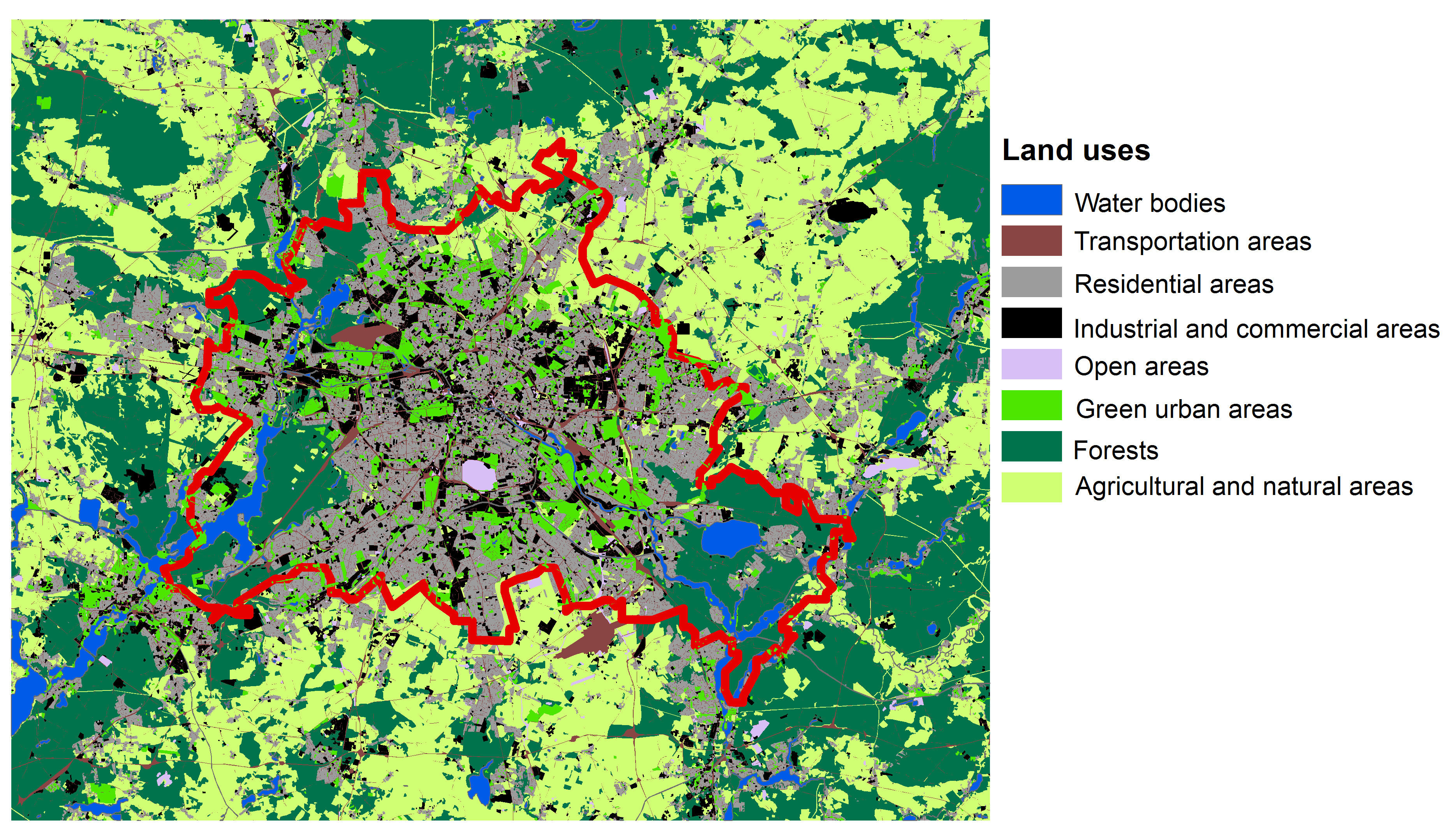
This categorized map has been extracted from the land use map developed by the European Environmental Agency.
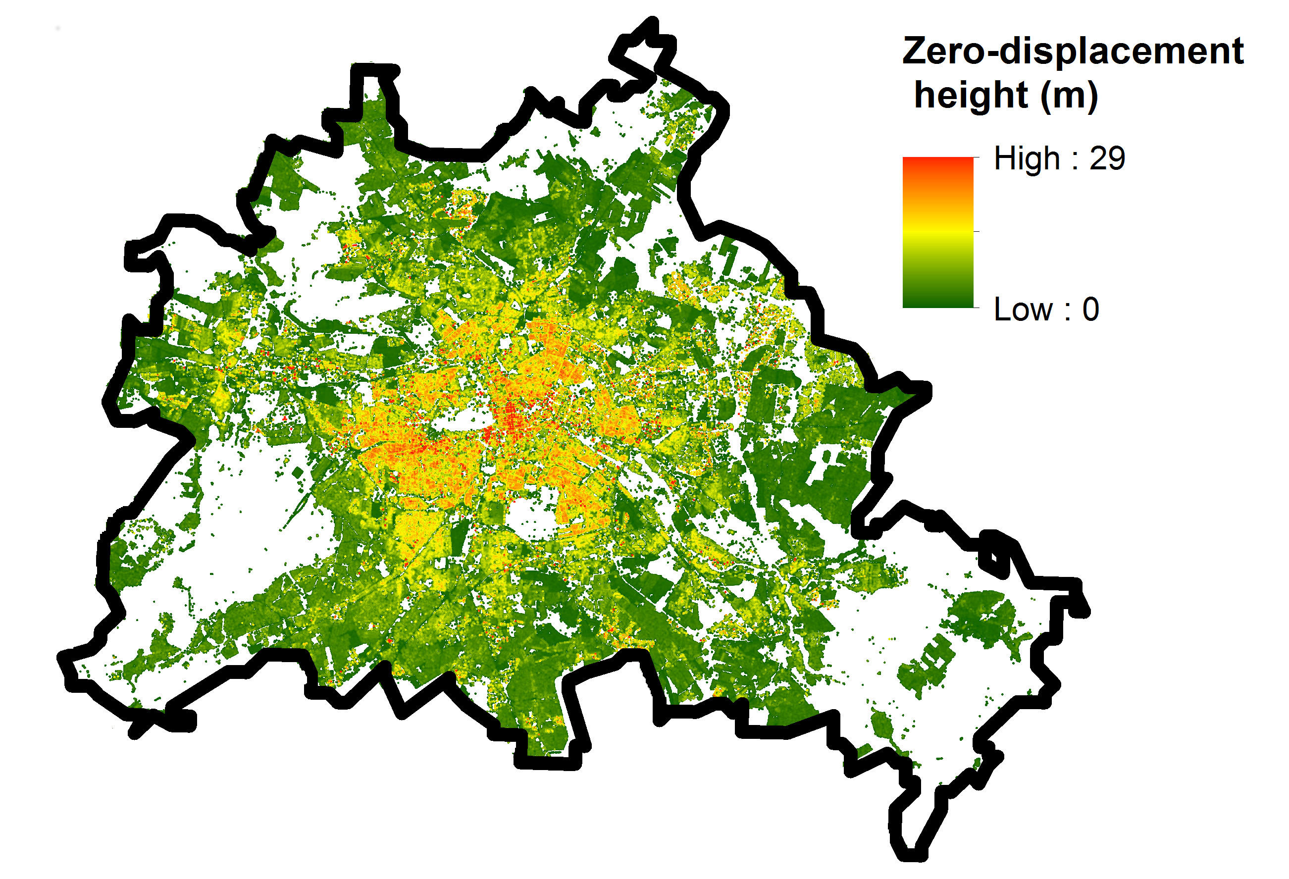
2. Zero-plane displacement height (roughness map)
The roughness map of Berlin (buffer radii: 50m) has been calculated by the urban climate working group for the built-up areas in Berlin (see the following figure). Berlin's built-up area map, developed by the Senate Department for Urban Development and the Environment, has been employed for the calculation of the roughness map.
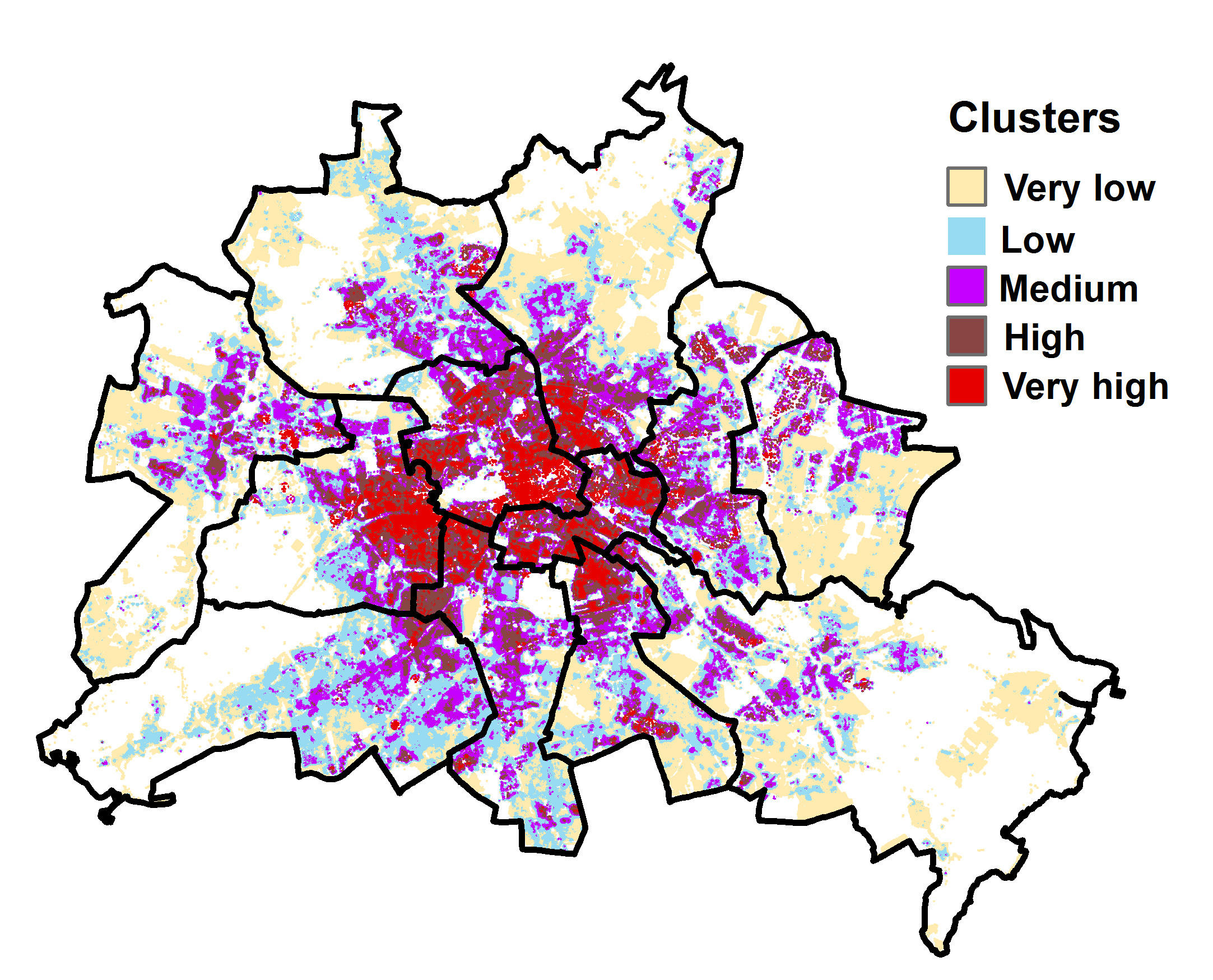
3. Berlin roughness clusters
ISODATA technique was employed for the clustering of zero-plane displacement height maps with different buffer radii and the zero-plane displacement height clusters were extracted for Berlin (see following figure).
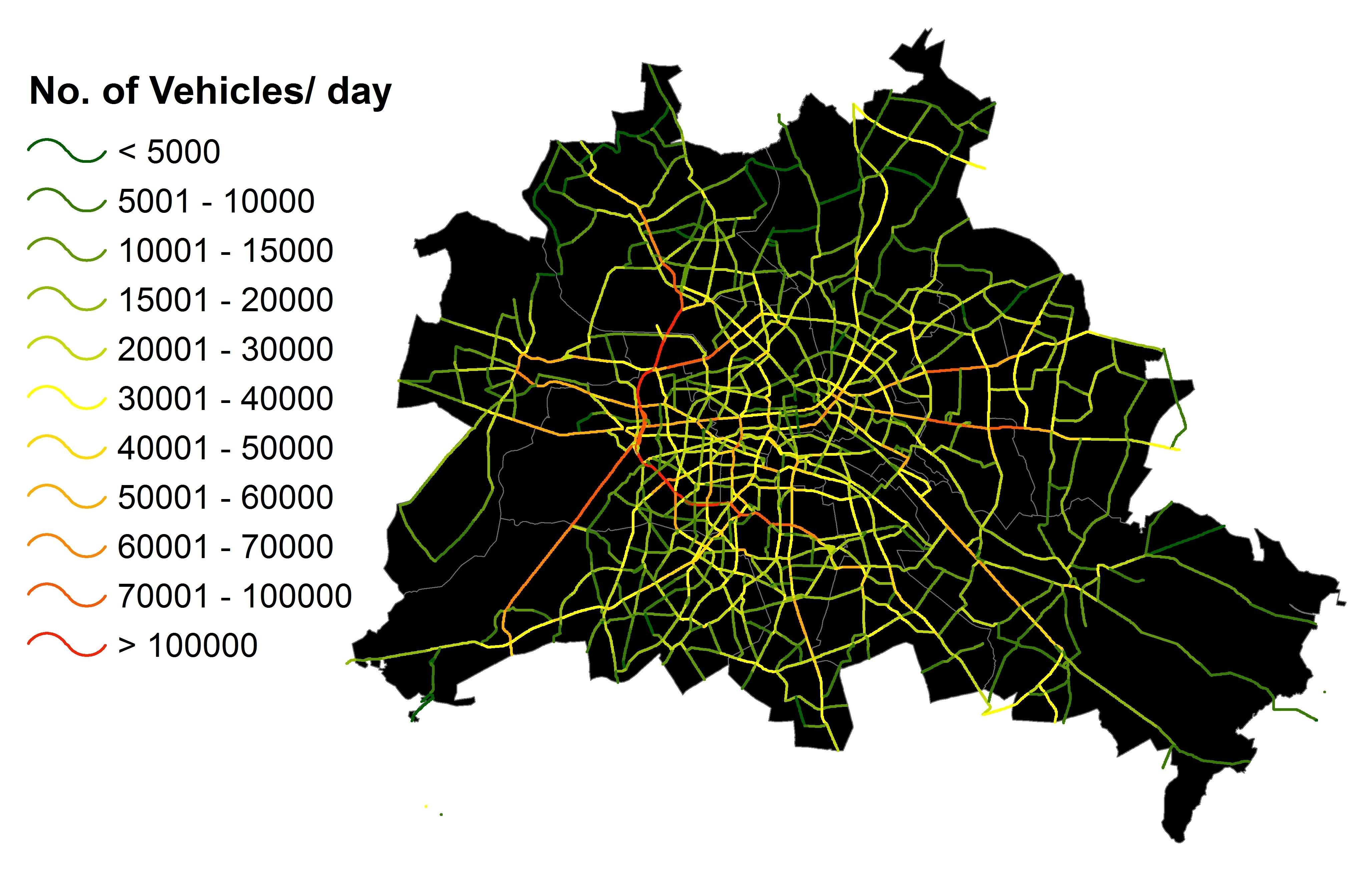
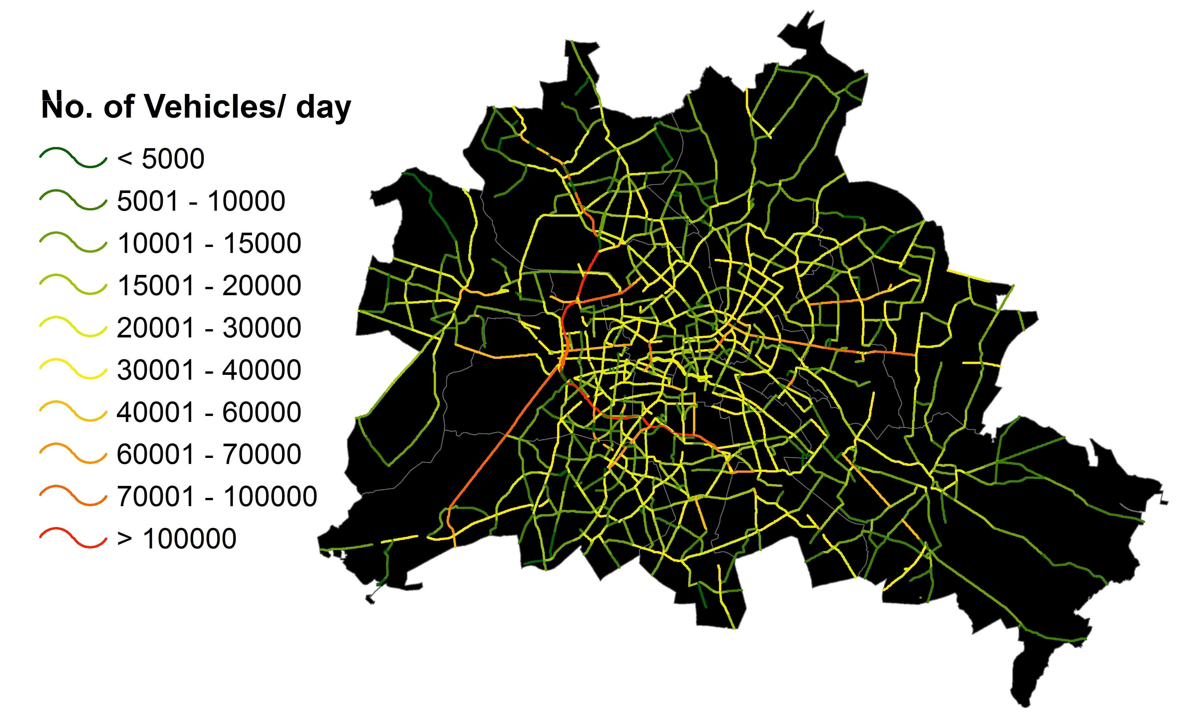
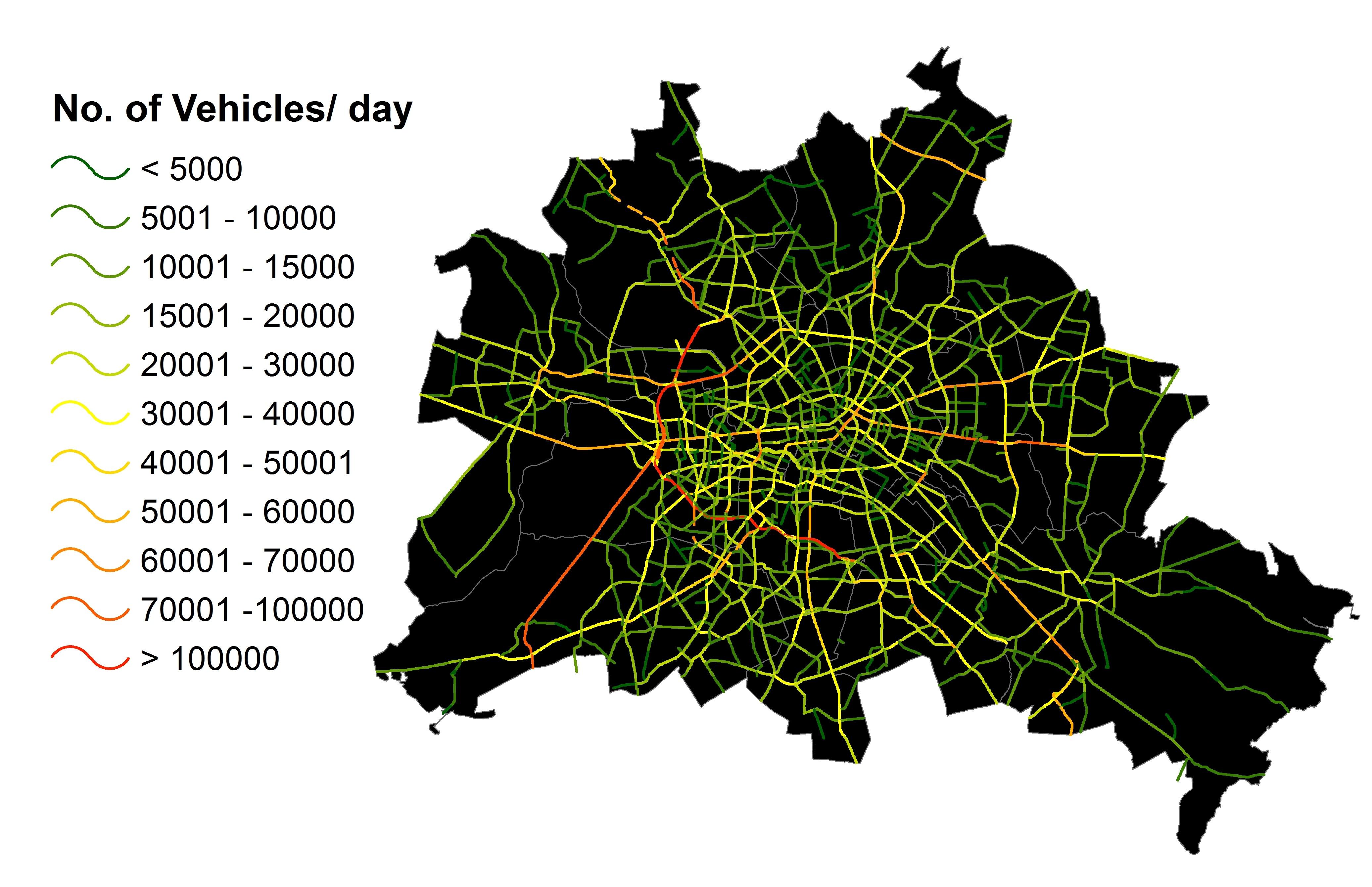
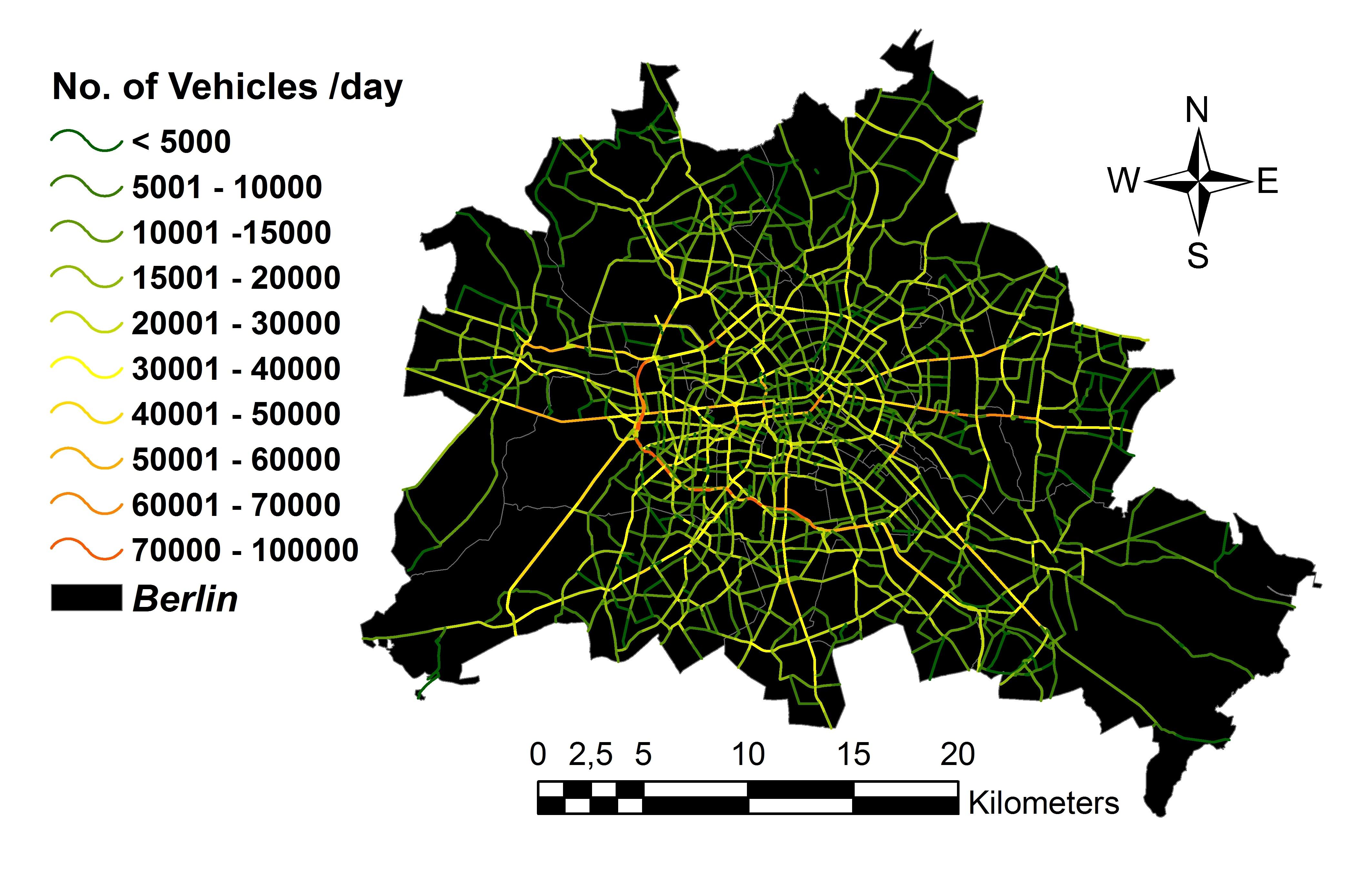
4. Traffic maps
GIS maps of Berlin's traffic intensity (mean daily traffic intensity (inv. nr. of vehicles/day)) were generated by the urban climate working group for different years (1995,2001,2005,2009). These traffic intensity maps have been extracted from traffic files (.pdf files) of Berlin's Senate.
The following figures show the traffic intensity maps for different years:
Traffic Intensity 1995
Traffic Intensity 2001
Traffic Intensity 2005
Traffic Intensity 2009
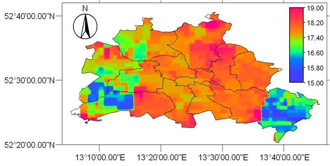
5. Air temperature maps
The urban climate working group has developed a fuzzy modelling technique for the simulation of air temperature in Berlin. The model output is presented as GIS (ILWIS) files.
The following figure shows a sample GIS output of air temperature (°C) model in Berlin. The MODIS products and the data of the meteorological stations have also been employed as input variables in this model.